We are identifying areas of concern with Artificial Intelligence in Central America using a proprietary methodology. These communities are at risk of Food and Nutrition Insecurity, we are therefore attempting to characterize them through data analysis and statistical techniques based on sociodemographic, territorial and climatic information. The aforementioned is facilitating the prioritization of decision-making and support provided by NGOs based on the risk they present..
The procedure is as follows:
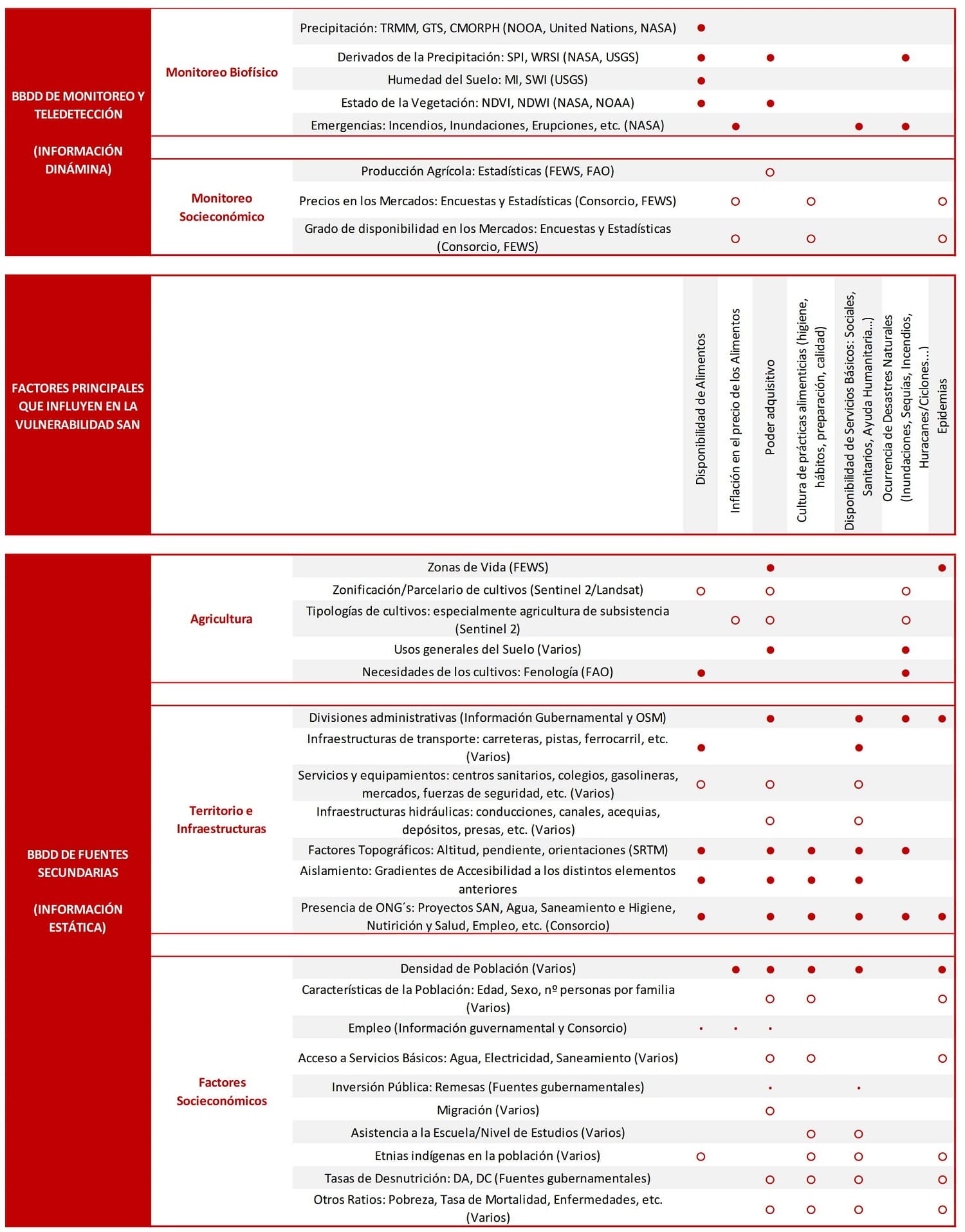
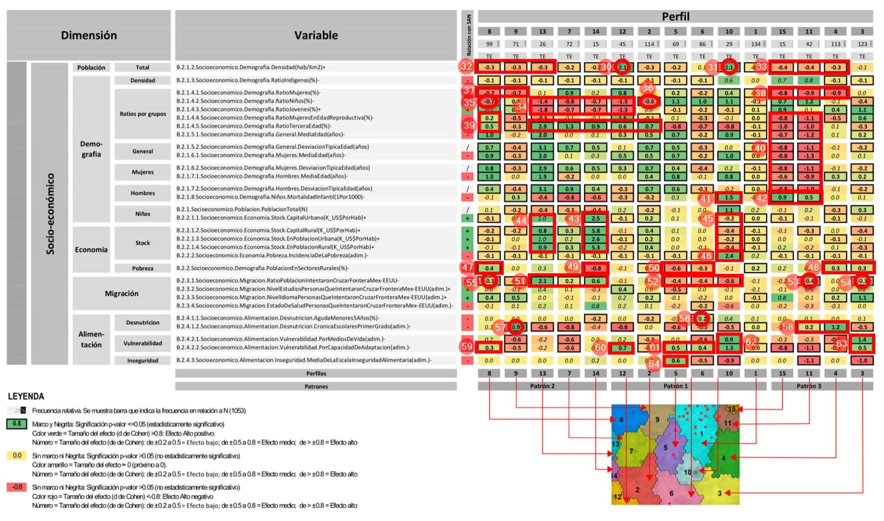
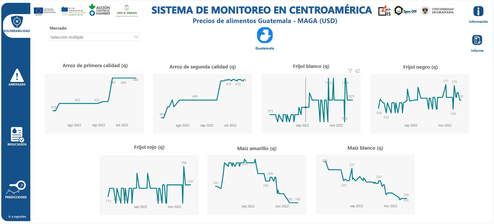
To estimate these areas of concern 100 thematic variables were selected that are directly or indirectly related to the Food and Nutrition Security and that influence it (agro-climatic, socio-economic and direct food and nutritional security).
All these variables are jointly included within a Data Warehouse and integrated in a homogeneous and structured way. Subsequently, an analysis model is estimated with an Artificial Intelligence process of unsupervised learning Artificial Neural Networks that generates profiles by means of a Self-Organizing Map (SOM).
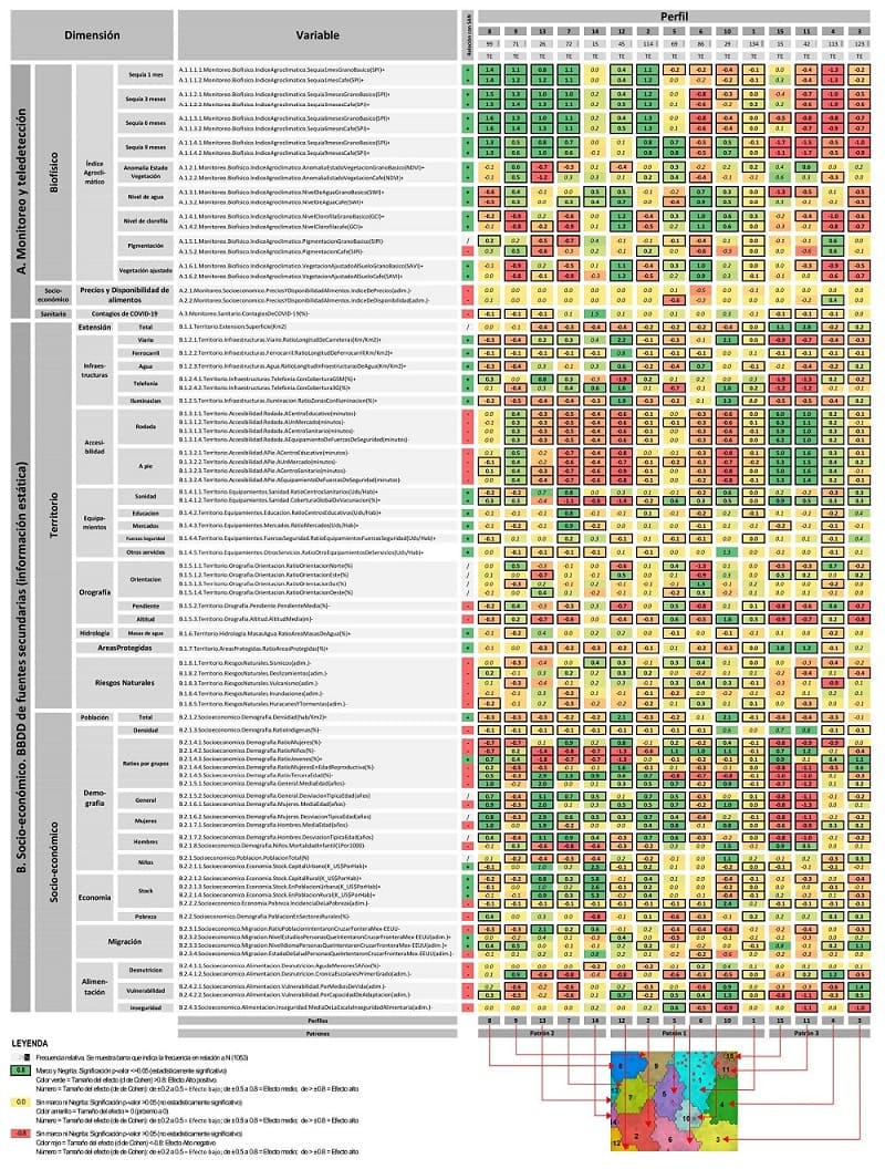
The 15 profiles have been generated The values in green indicate positive and direct influence of the variable belonging to a dimension on the profile and the values in red are those that influence indirectly and negatively, which indicates which variables are affecting that profile the most.
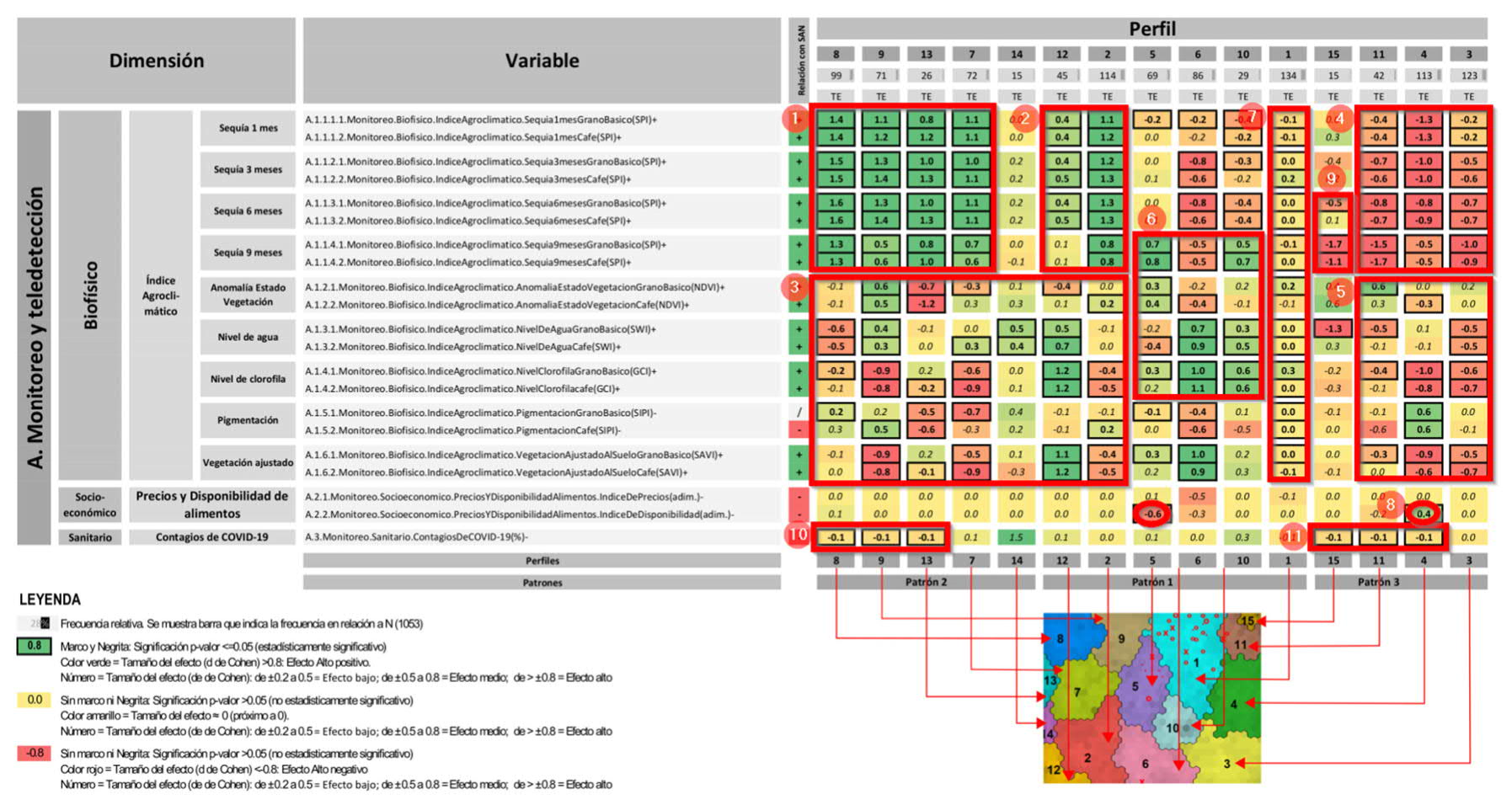
For example, in the "Monitoring and remote sensing" dimension and, specifically in its biophysical variables, it can be observed that Profiles 8, 9, 13, 7, and 2, and to a lesser extent in Profile 12, all have very high SPI drought indices, which shows that rainfall is high, which influences the lack of problems in the basic grains and coffee plantations.
If we continue analyzing the general results of the "Territory" dimension, we can see that the lowest infrastructure ratio values are found in Profiles 15 and 11, coinciding with the municipalities with the largest surface area in absolute terms, which means that these territories take the longest time on average to reach a facility, either on foot or by car.
Analyzing the "Socio-economic" dimension, it can be seen that there is a singularly high population density in Profiles 12 and 10 and low in Profiles 8, 9, 13, 15, 11 and 4.
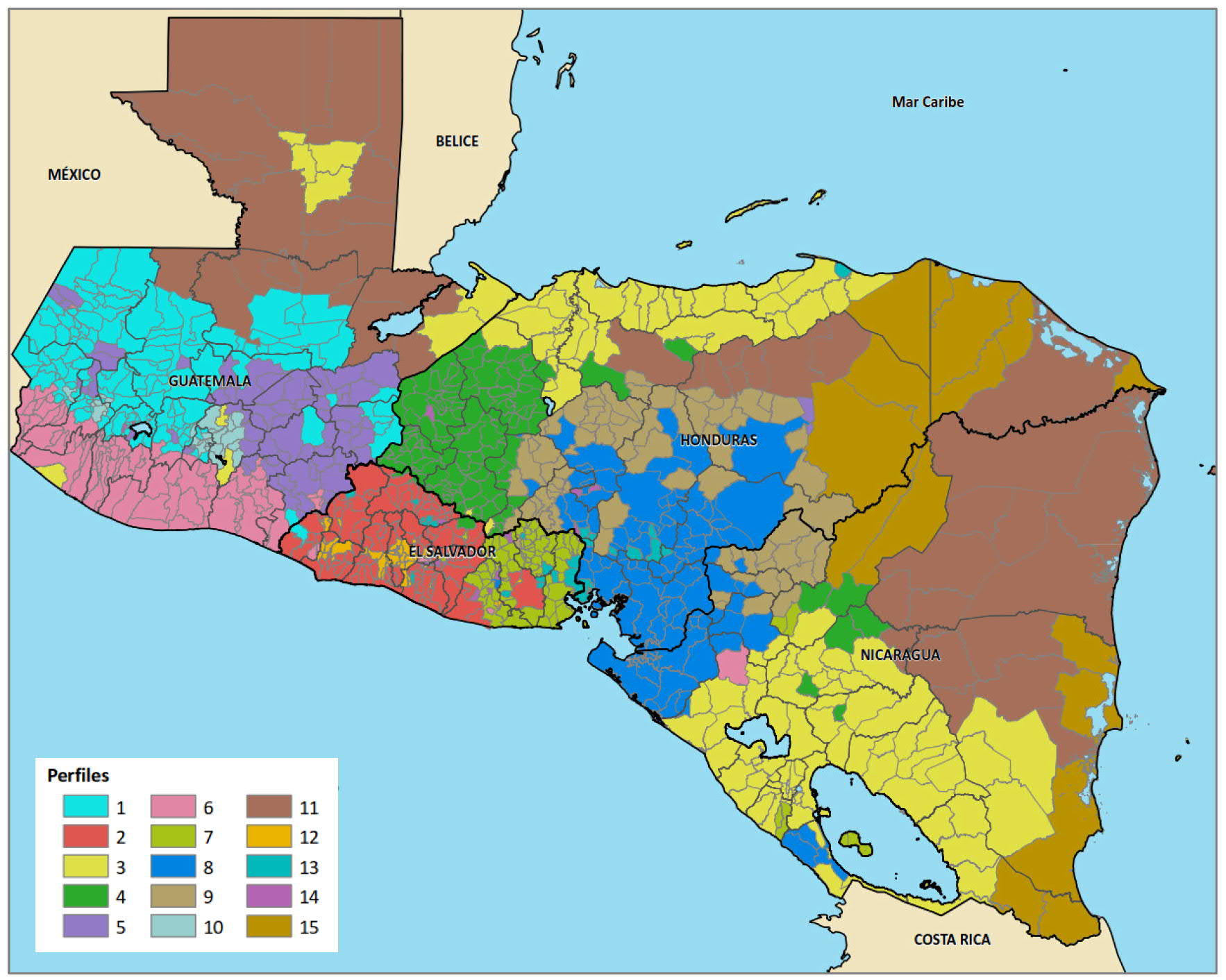
As a final result we find This map shows the distribution of the 15 resulting profiles mentioned above, based on the 1053 municipalities studied throughout Central America: Honduras, Guatemala, El Salvador and Nicaragua..
In addition, it has been possible to draw conclusions about the problems they present and which are important enough to be evaluated and dealt with by NGOs and public bodies.
Positive Food Availability Index. Seismic and volcanic risks. Low presence of the elderly. Very high Food insecurity.
These profiles are highly correlated with the concept of "Livelihoods" very often used by the humanitarian sector to differentiate between groups of people with different characteristics, and therefore different needs. However, these profiles are much more complete as they include many more variables and realities, which makes them more representative and useful for decision making.
Correo electrónico: info@gis4tech.com
