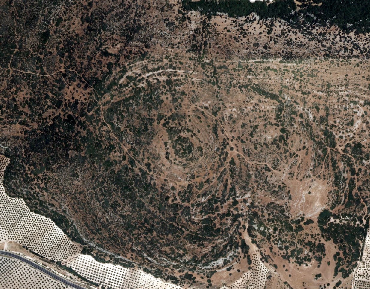
In 2014, we started documenting the first signs of an archaeological site in caves between Colomera and Montillana. Subsequently, in 2016, following the observation of remote sensing images, an anomalous growth of vegetation in the area revealed 3 concentric circles on a mountain in the area. It was not until 2020 when the studies were completed to certify that it was an anomalous growth. 4,500 year old citadel composed of three concentric lines of walls.
This project was developed by students of the Archaeology Degree and Master of the University of Granada and by GIS4tech. Our part consisted of obtaining, from the LiDAR (Light Detection and Ranging) point cloud of the National Plan of Aerial Orthophotography of the National Geographic Institute - PNOA of the highest precision bending of Chalcolithic sites found in the field.
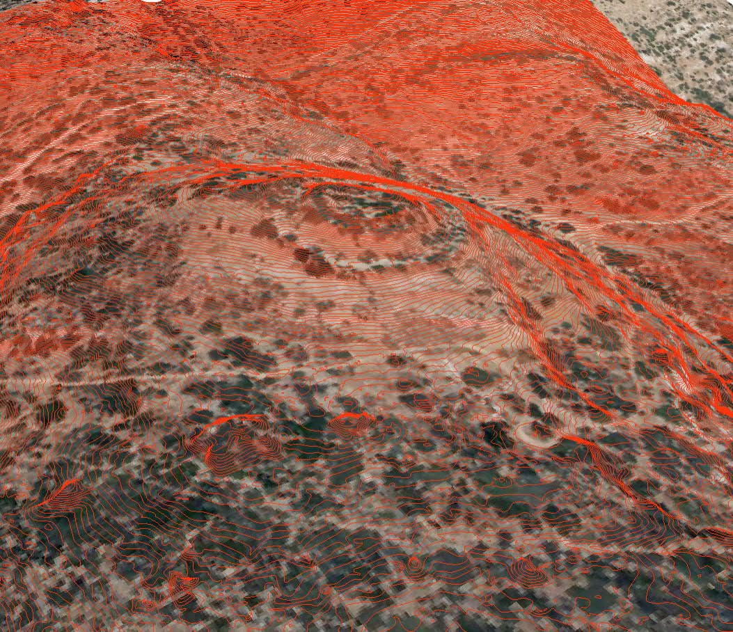
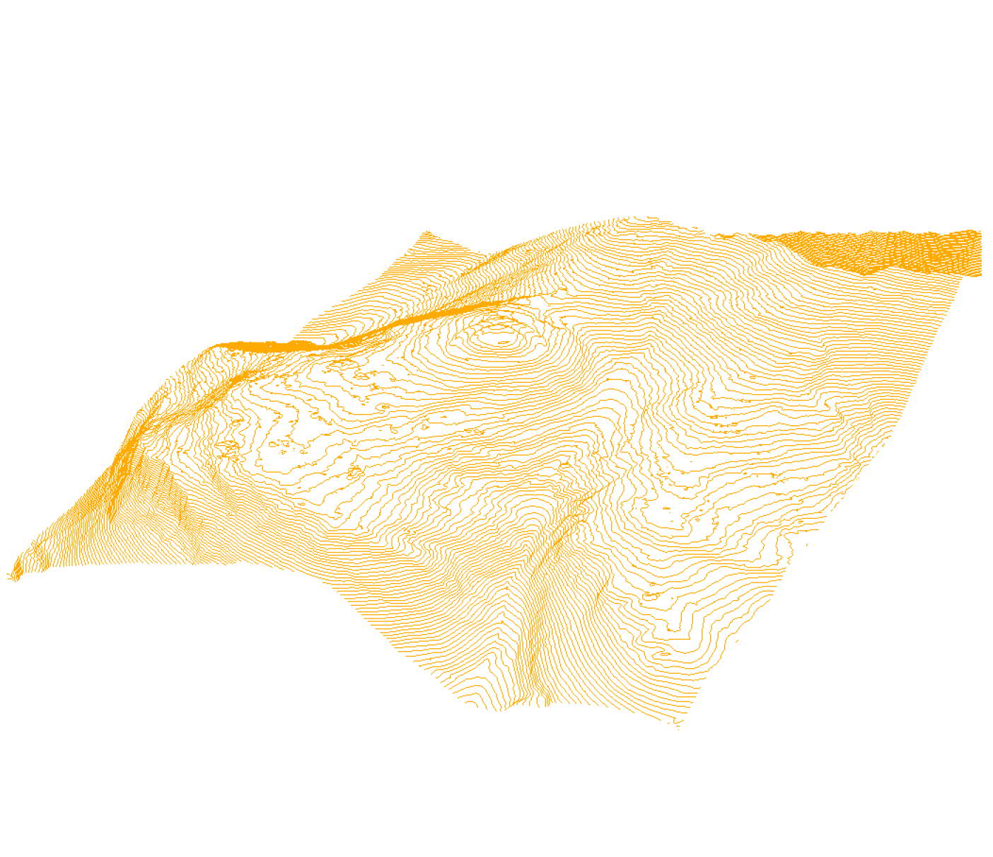
The intention was to show, on the basis of these curves, the approximate shape of these sites, which, as mentioned above, were hidden among the rocks and vegetation. This is what made it clear that it was a citadelThe discovery of its shape and structure revealed that it was a prehistoric construction, strategically built, both in terms of its location and the architecture of the building, designed to protect its interior and to evade attacks.
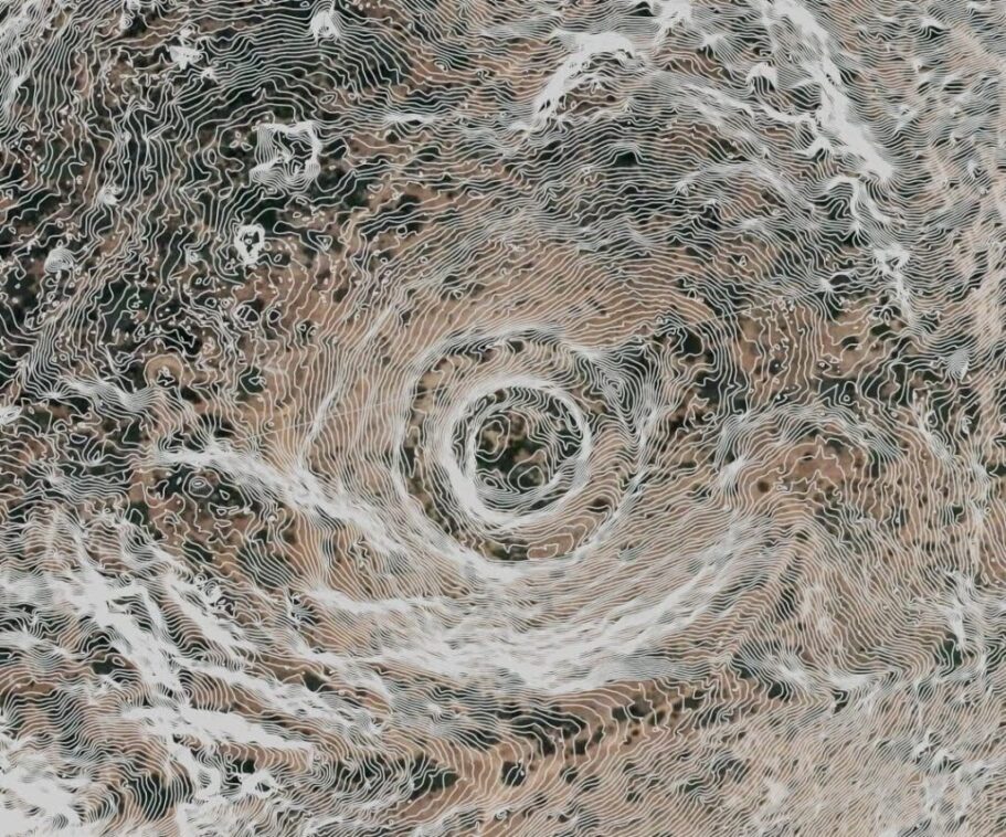
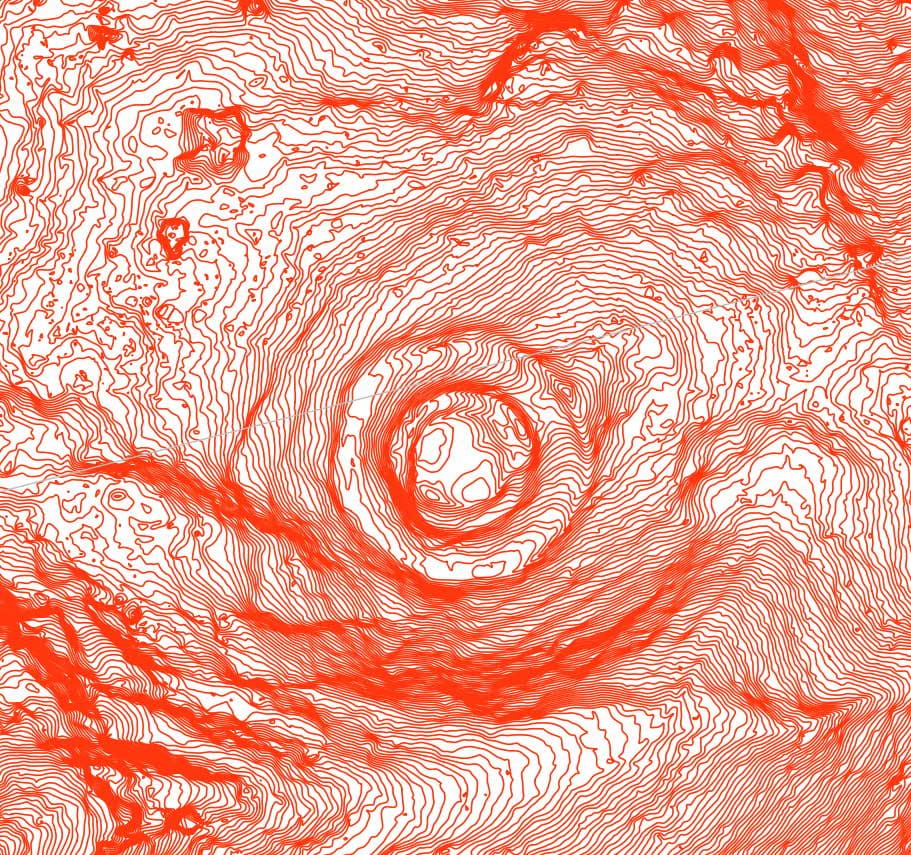
For this purpose, the LiDAR point cloud was manually processed and filtered using advanced GIS software. These point clouds LiDAR , have a cartographic resolution of 0.5 georeferenced points per square metre, with an altimetric accuracy of approximately 20 cm. With this, after filtering, reclassification and error cleaning, Digital Terrain Models (DTM) of cell size (or grid pitch) 0.25 m or less were constructed, from which contour lines were drawn to an accuracy of 25 centimetres, showing the concentric formations of the site walls.
Correo electrónico: info@gis4tech.com
