This project is being carried out to respond to the uniqueness and complexity of the current problems in the area of Bassikounou, Mauritania, for which it was necessary to create and implement a new tool of planning and diagnosis in the environmental and social sustainability field, as well as the elaboration of a long-term territorial forecasting based on the development of different scenarios of the water resources evolution in the region of Bassikounou.
Specifically, some of the purposes for this project have included the implementation of plans for the development of the communities through the use of the ground, implementation of participatory democracy mechanisms to improve the lives of the communities and reduce the exclusion perception and the facilitation of access to basic services through the study of the possibilities of technological increase to promote the development of the area. In short, create favorable conditions for the economic growth of the area, decent employment, and peace.
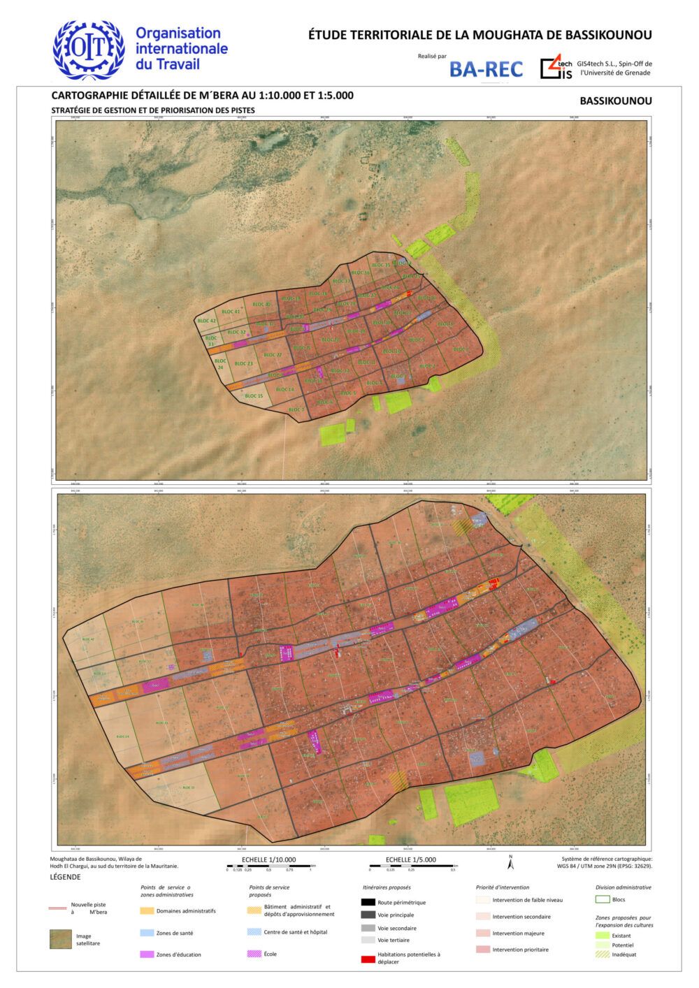
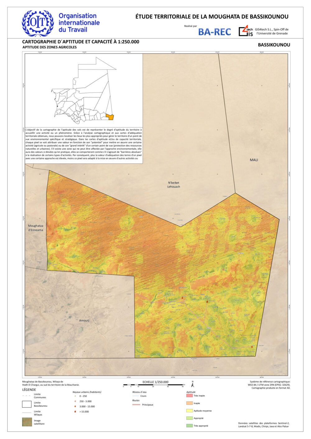
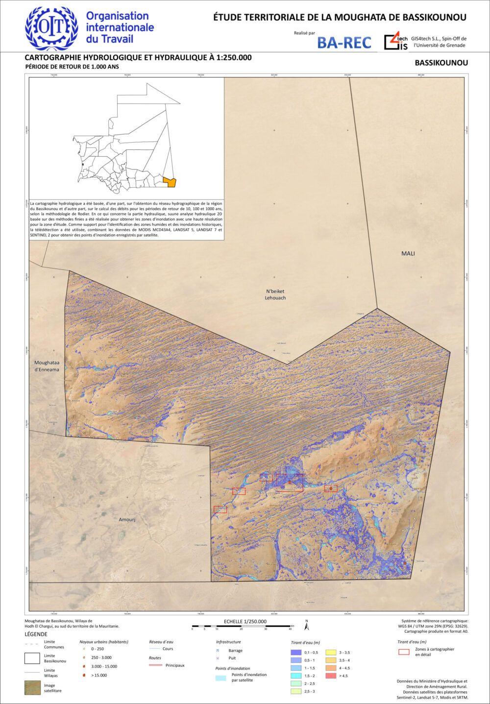
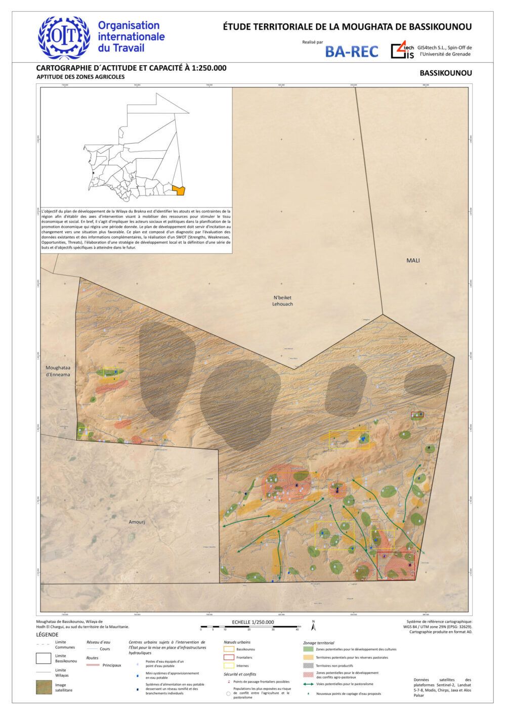
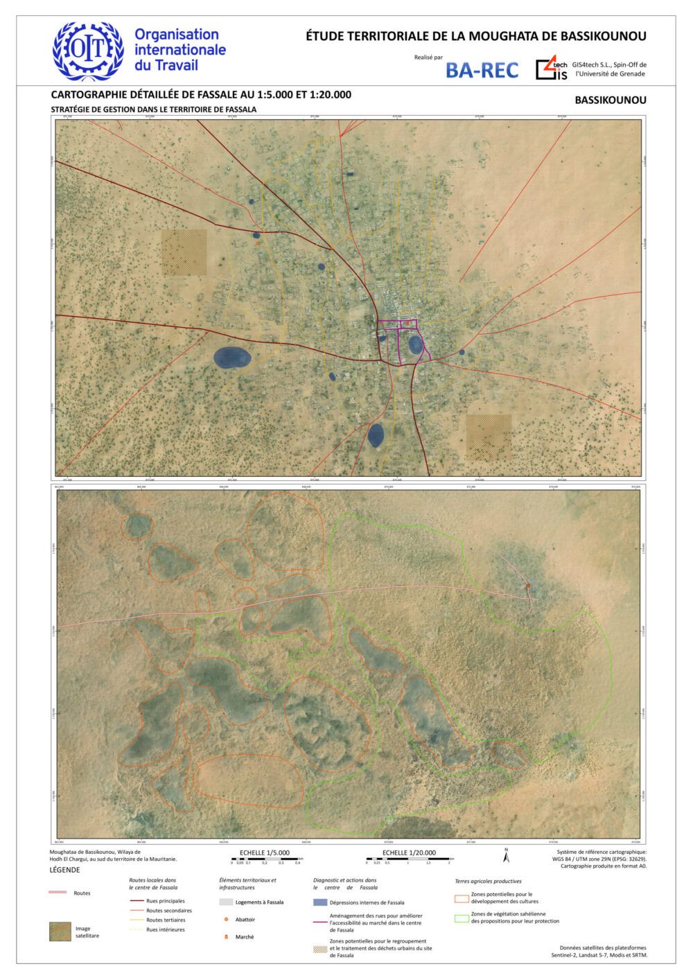
The development plan consists of the execution of different sub-projects: Hydrology Studies, Acquisition and Processing of Satellite Images, Socioeoconomic Situation Cartographies of the Towns of the Region, Mapping the Road Network, Ecological Zoning, Development of Agriculture and Pastoralism, Skills and Capacity mapping, Detailed Urban Analysis of the Paths and Roads Layout, Analysis of Structural Measures, Development of an Productive Agricultural Area, Creation of a local Market and the Development of the Meat Industry.
Correo electrónico: info@gis4tech.com
