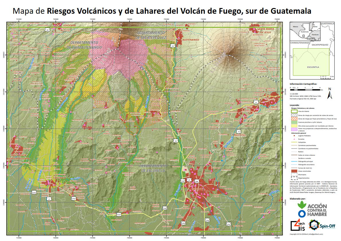
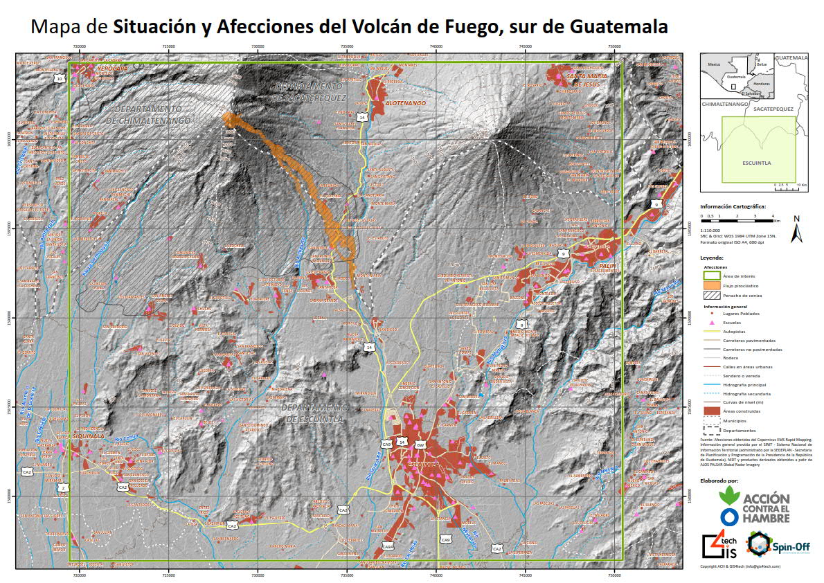
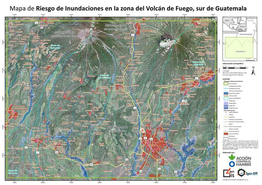
On 3 June 2018, the Fuego volcano, 40 km from Guatemala City, erupted. The most affected areas were Chimaltenango, Sacatepéquez, Escuintla, Mixco and some areas of Guatemala City. The number of people sheltered was close to 4,500, although 8,050 people have been officially evacuated. The objective of this project was to create the maps used by the Action Against Hunger teams working in Guatemala to help them coordinate and provide a more effective response, for example, to know where to locate shelters or to know which populations will require evacuation in the event of new seismic movements. Satellite images combined with information obtained from Guatemala's national systems or digital terrain models produced by NASA, among other data, were used for this purpose.
Cartography is scarce in Guatemala, and in an emergency situation such as this, a map is an indispensable guide. These designs have captured on paper the effects of the eruption of the Volcán de Fuego, showing built-up areas, schools and roads, and areas prone to lahars: roughly speaking, streams of water, stone and ash, among other materials, that slide down the slopes of the volcano.
Correo electrónico: info@gis4tech.com
