Study of Local Effects Induced by Earthquakes in the Autonomous City of Melilla
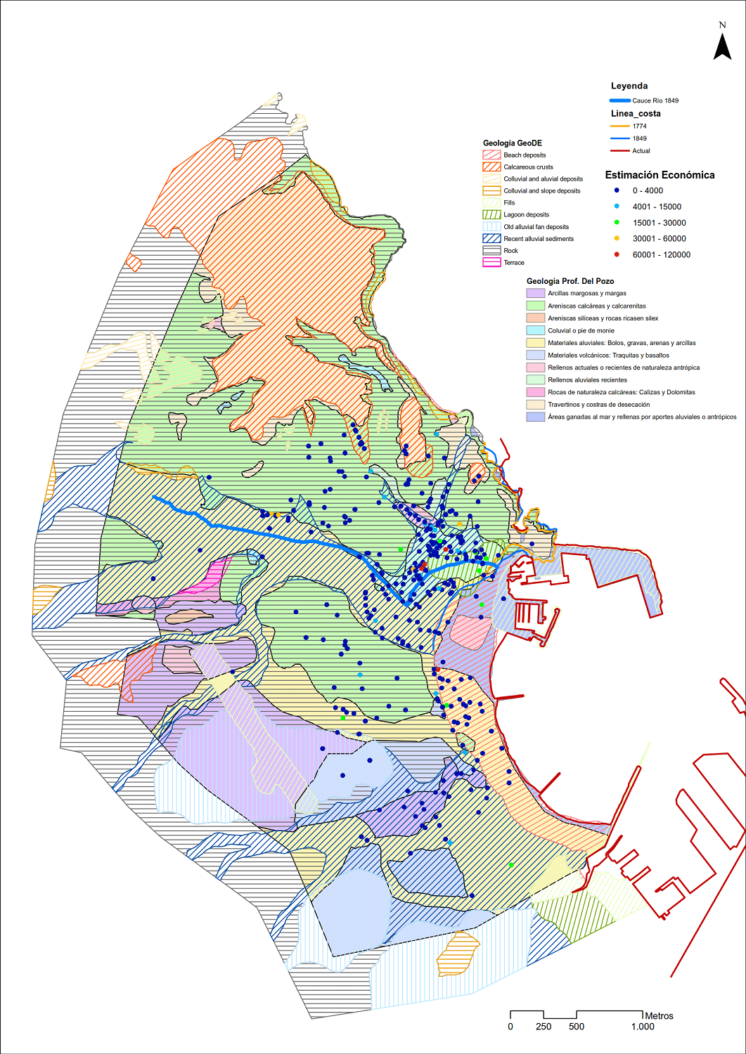
Hydrological data and their correlation with earthquake damage in Melilla were analysed. From this, cartographies and visualisations were generated using GIS, as well as statistical correlations.