
This project consisted of the drafting of a preliminary feasibility study for the nature trail that runs through the municipalities of Alicún de Ortega, Villanueva de las Torres, Dehesas de Guadix, Bacor-Olivar and Gorafe.
To do so field reconnaissance activities were carried out through visits to the study area, topographic surveys by restitution of the terrain using LiDAR techniques to generate contour lines along the entire length of the route, and a Data Model was created that integrates all spatial information created and incorporates layers of information in the different coverages to record future changes, issues, security issues that arise after the completion of the Nature Trail.
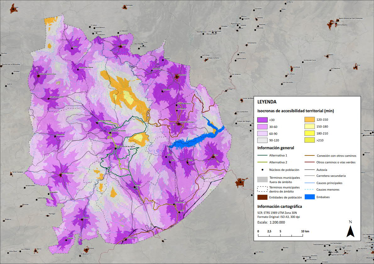
Territorial Accessibility Isochrone Mapping of Nature Trail Alternatives
The report incorporates several maps that visually reflect the values obtained by each alternative with respect to certain indicators. The values for each indicator are added up and compared between the alternatives to find out which is the most feasible alternative for the Nature Trail. Some of these indicators are: Accessibility, Social Suitability, Economic Cost and Natural Hazards.
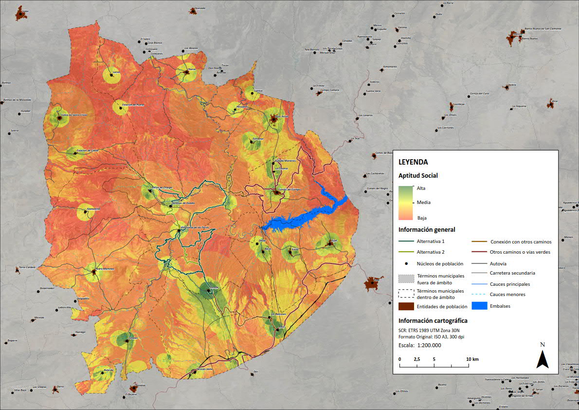
Social Suitability Mapping for Nature Trail Alternatives
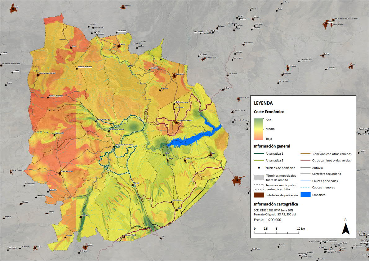
Economic Cost Mapping as a function of the Nature Trail Alternative
In the project a Land Aptitude model was designed in raster format according to different dimensions (environmental, social and economic) and a prior modelling of the possible minimum cost corridors or paths was carried out, based on the cost-distance methodology, a new and innovative GIS technique extensively tested within the Urban and Regional Planning Laboratory of the University of Granada.
Cost maps are often used to calculate the minimum cost path between two cells or groups of cells. The system is able to find the optimal path in a way that minimises costs. The result is a set of aligned cells that mark the optimal, least-cost path according to the chosen criterion, i.e. the path that has the highest suitability for the implementation of an infrastructure according to that criterion.
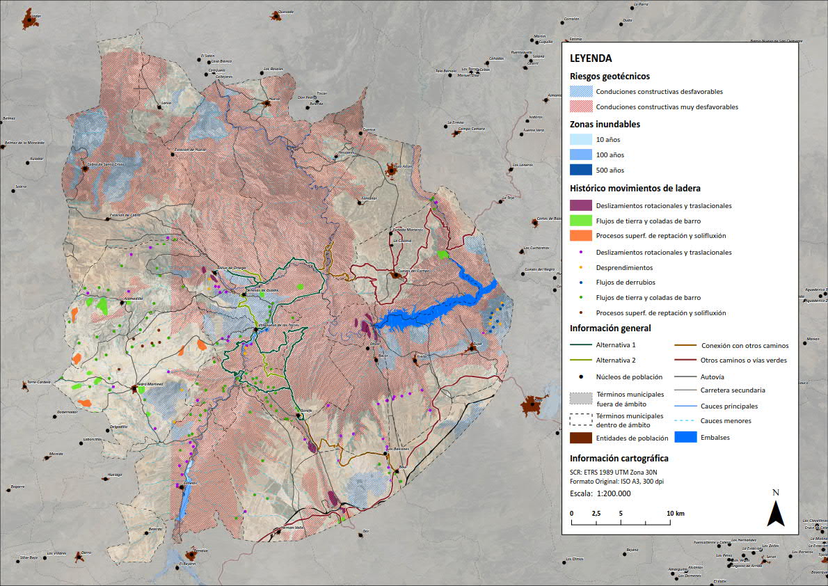
Geotechnical risk mapping in areas close to the Nature Trail alternatives.
Correo electrónico: info@gis4tech.com
