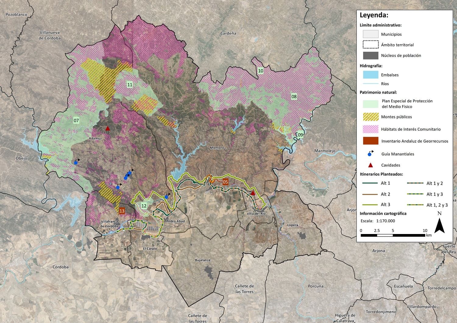
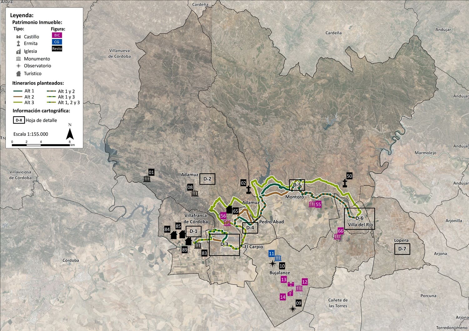
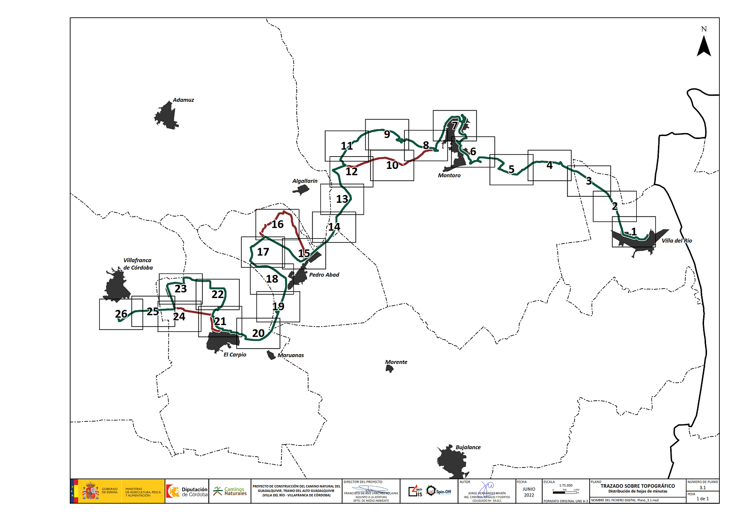
This project proposed the development of a Study of Alternatives for the selection and subsequent construction of the optimum alternative for the layout of a Nature Trail connecting the towns of Villa del Río and Villafranca de Córdoba parallel to the River Guadalquivir, with minimal environmental impact. In order to plan the alternatives, an intensive analysis of the historical paths in the area was carried out using maps from the National Geographic Institute (IGN). The specific situation of the current network of nature trails and the possible integration of the future proposed nature trail into this network and with other compatible networks were also studied.
After carrying out a suitability analysis based on criteria of potential demand, connectivity potential, suitability of the route, presence of agro-environmental and cultural values, accessibility analysis and economic viability and tourist or leisure interest, two alternative routes were proposed, which are complemented with various access routes from/to nearby population centres and areas of interest. For all this, a GIS methodology was used, applied and tested extensively within the Urban and Territorial Planning Laboratory of the University of Granada, applying the cost-distance algorithm, which allows the calculation of the lowest accumulated cost in terms of environmental, social and economic cost of the alternative to the nearest objective (ESRI, 2004).
Correo electrónico: info@gis4tech.com
