HYPERION is a research project of the European Union that focuses on the development of a decision support system for enhancing resilience and sustainable reconstruction of historic areas to cope with climate change and extreme eventsbased on novel sensors and advanced modeling tools.
The HYPERION goals are:
HYPERION is conducting extensive testing at four demonstration sites, in Greece (Rhodes), Spain (Granada), Norway (Tønsberg) and Italy (Venice). The historic areas will be modeled at the building level using reduced order models based on archetype structures for each area. Several selected structures (CH value) will be modeled and monitored in detail. The demonstration will confirm the suitability of the HYPERION platform for multi-risk assessment and optimized operational and strategic decision making for the management and maintenance of historic areas, taking into account also other risks relevant to other sections of the city.
Our partner and researcher at the Higher Technical School of Civil Engineering of the University of Granada, Emilio Molero Melgarejo has contributed to the project by generating a database on exposure of buildings and infrastructures that are necessary for the risk and resilience assessment of the 4 pilot cities mentioned above..
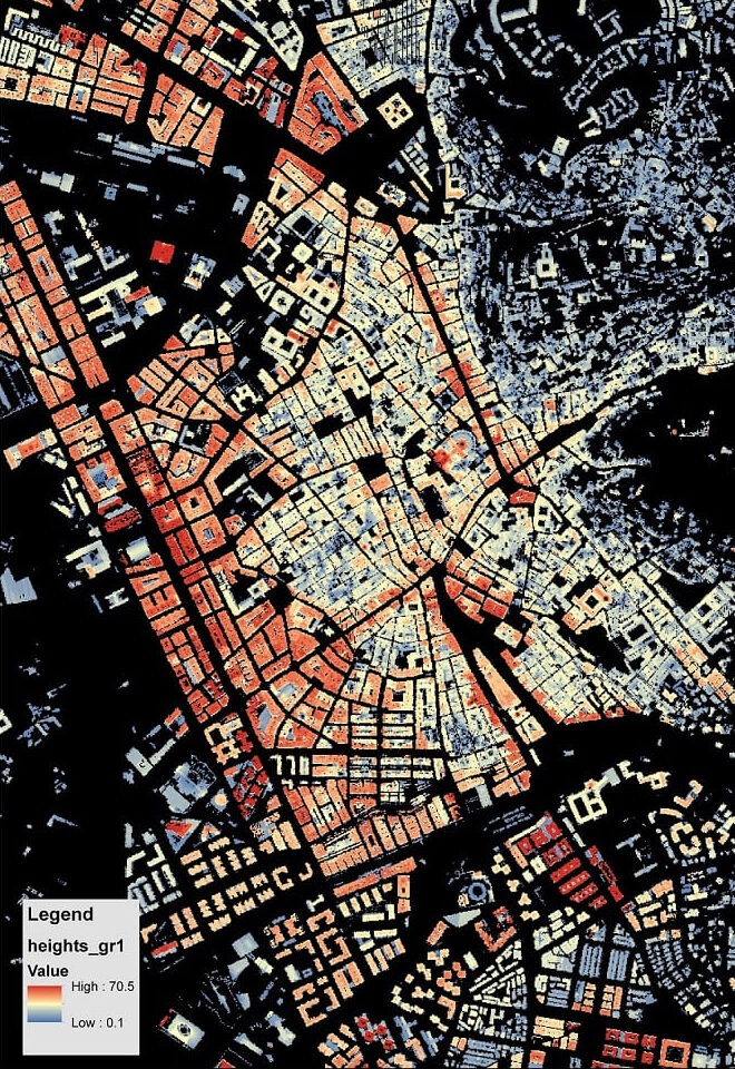
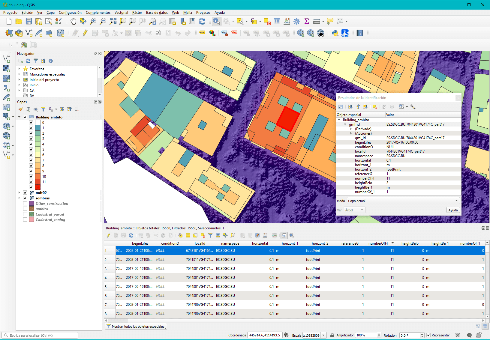
The age of the building and its height have been two of the most important variables to take into account. For this purpose, the integration of LiDAR technology and Cadastre databases have been decisive:
HYPERION is a research project of the European Union that focuses on the development of a decision support system for enhancing resilience and sustainable reconstruction of historic areas to cope with climate change and extreme eventsbased on novel sensors and advanced modeling tools.
The HYPERION goals are:
HYPERION is conducting extensive testing at four demonstration sites, in Greece (Rhodes), Spain (Granada), Norway (Tønsberg) and Italy (Venice). The historic areas will be modeled at the building level using reduced order models based on archetype structures for each area. Several selected structures (CH value) will be modeled and monitored in detail. The demonstration will confirm the suitability of the HYPERION platform for multi-risk assessment and optimized operational and strategic decision making for the management and maintenance of historic areas, taking into account also other risks relevant to other sections of the city.
Our partner and researcher at the Higher Technical School of Civil Engineering of the University of Granada, Emilio Molero Melgarejo has contributed to the project by generating a database on exposure of buildings and infrastructures that are necessary for the risk and resilience assessment of the 4 pilot cities mentioned above..
The age of the building and its height have been two of the most important variables to take into account. For this purpose, the integration of LiDAR technology and Cadastre databases have been decisive:
Correo electrónico: info@gis4tech.com
