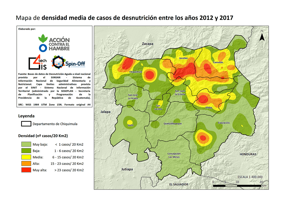
The present study is mainly oriented to show possible potential correlations between the incidence of Acute Malnutrition in the period between 2012 and 2017 and the isolation of rural communities in the Department of Chiquimula (Guatemala).
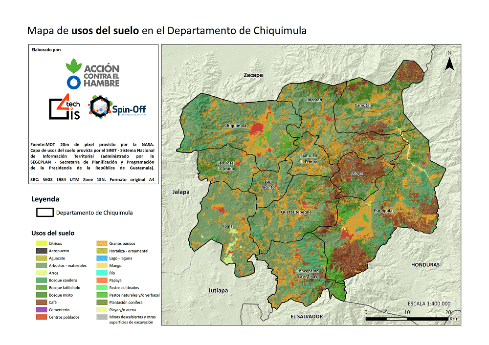
For the elaboration of this document it has been necessary to search and download Geographic Information from different organisms in Guatemala. In this process, it has been possible to obtain massive statistical information at the local level on education, health, infrastructure and economics, which has been correlated in the same way with the prevalence of Acute Malnutrition in the communities of the region under study. The correlations have been obtained through the use of Geographic Information Systems and cartographic resources in vector format (shapefile) and alphanumeric information (excel) obtained from various Geographic Information Sources.
The main objectives were as follows:
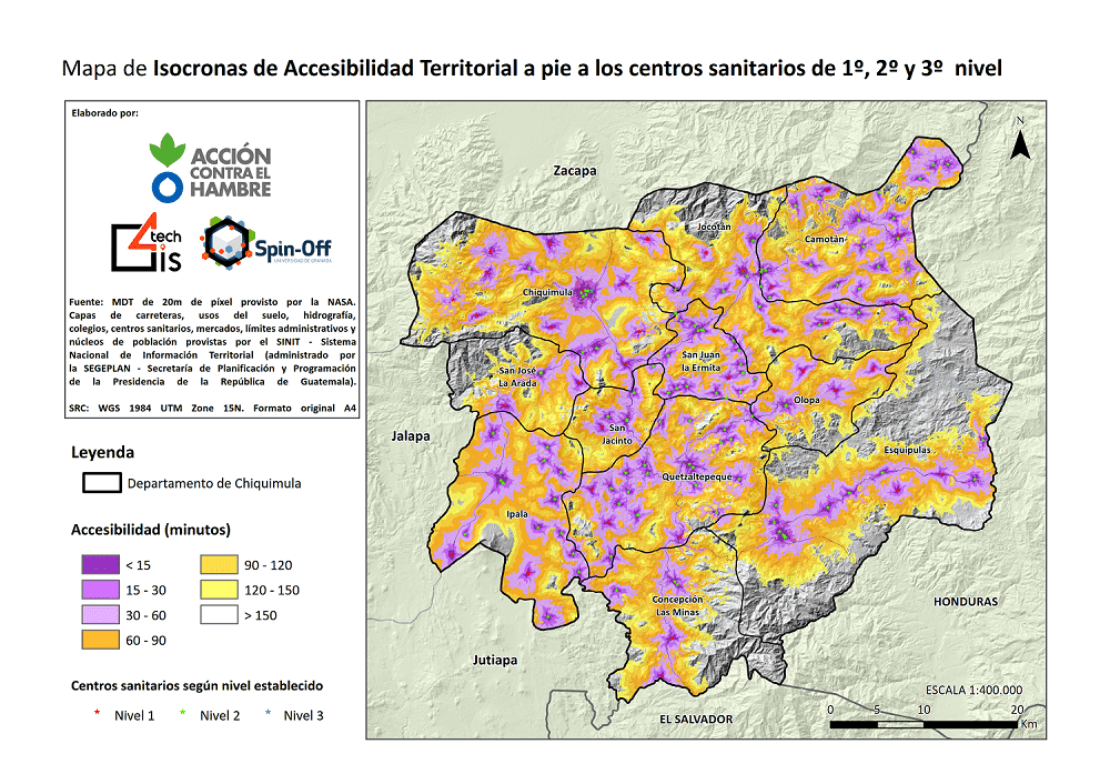
The process consisted, firstly, of obtaining thematic maps referring to the density of Acute Malnutrition using GIS software and geoprocessing; secondly, Isochrone maps were obtained that show the accessibility of the communities to the different types of services and entities (health centres, schools, markets, municipal centres, etc.); finally, all the multivariable statistical information found in the different organisations was studied and incorporated into the previously geo-referenced communities. After that, the multivariate statistical information found in the different agencies was studied and incorporated into the previously geo-referenced communities; and finally, all the previous analyses were correlated, trying to obtain evidence and possible correlations, according to the indications of the professionals of Action Against Hunger.
Correo electrónico: info@gis4tech.com
