
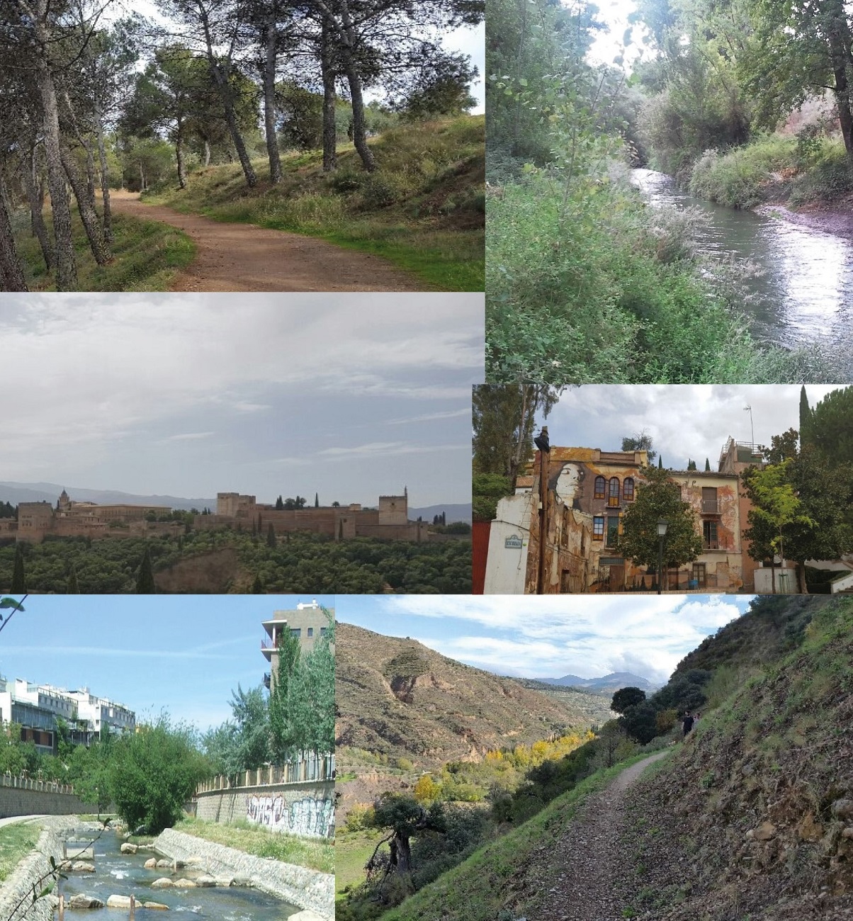
The study of the landscape of a territory needs to be approached from multiple dimensions. Our case focuses on specialised social media and their users, who identify itineraries by taking photographs, discovering and highlighting routes and places that sometimes constitute sources of information about these places and landscapes that are of great value.
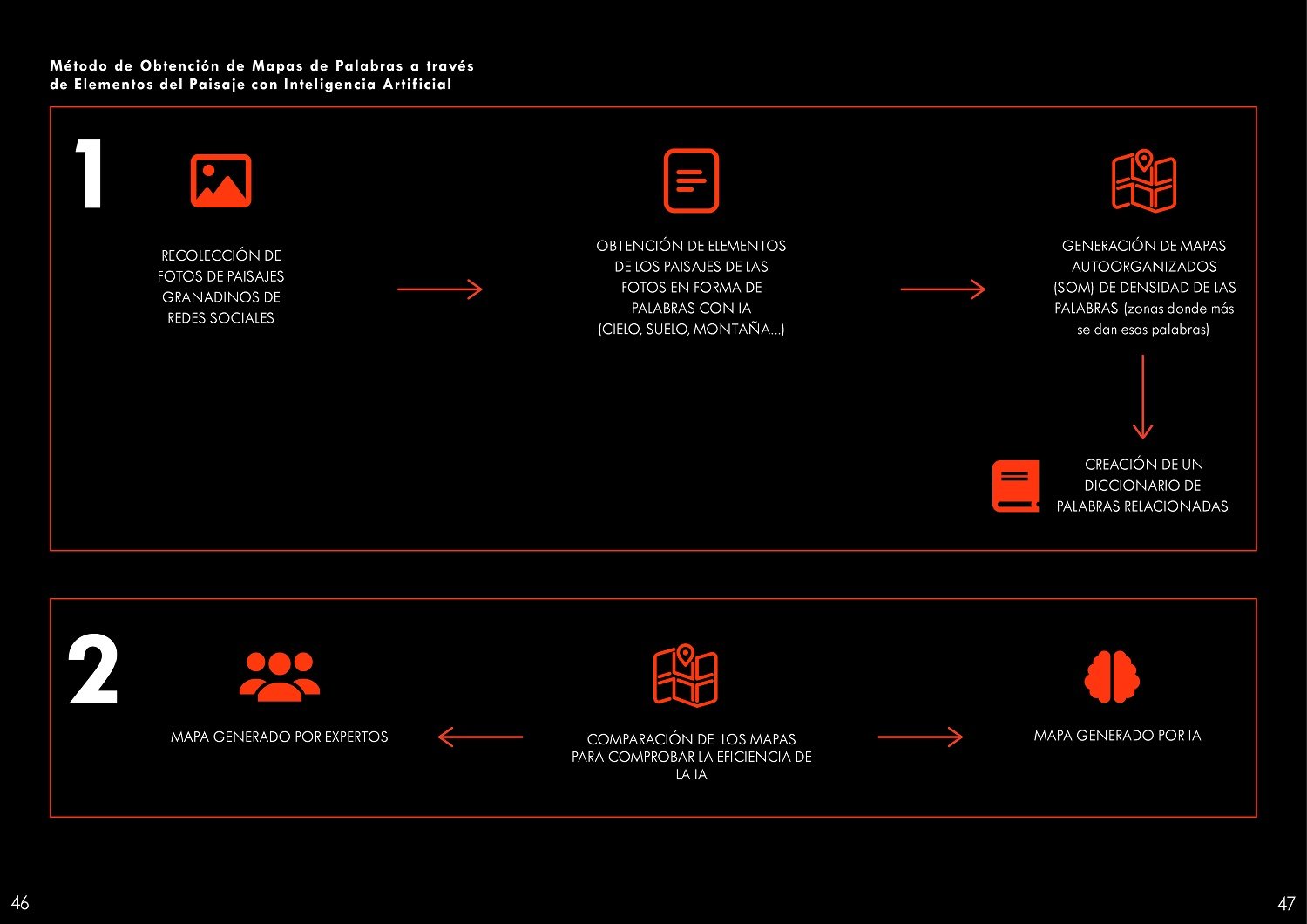
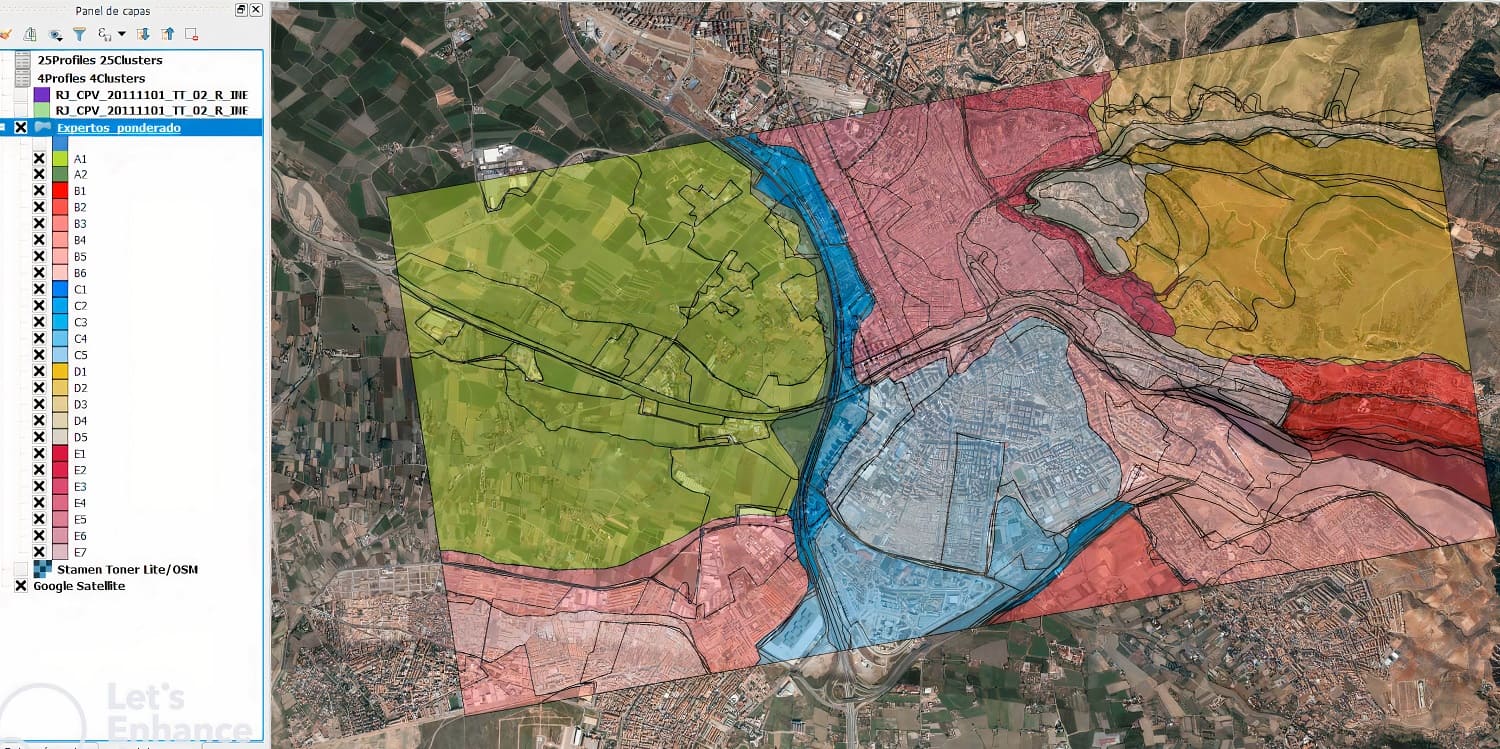
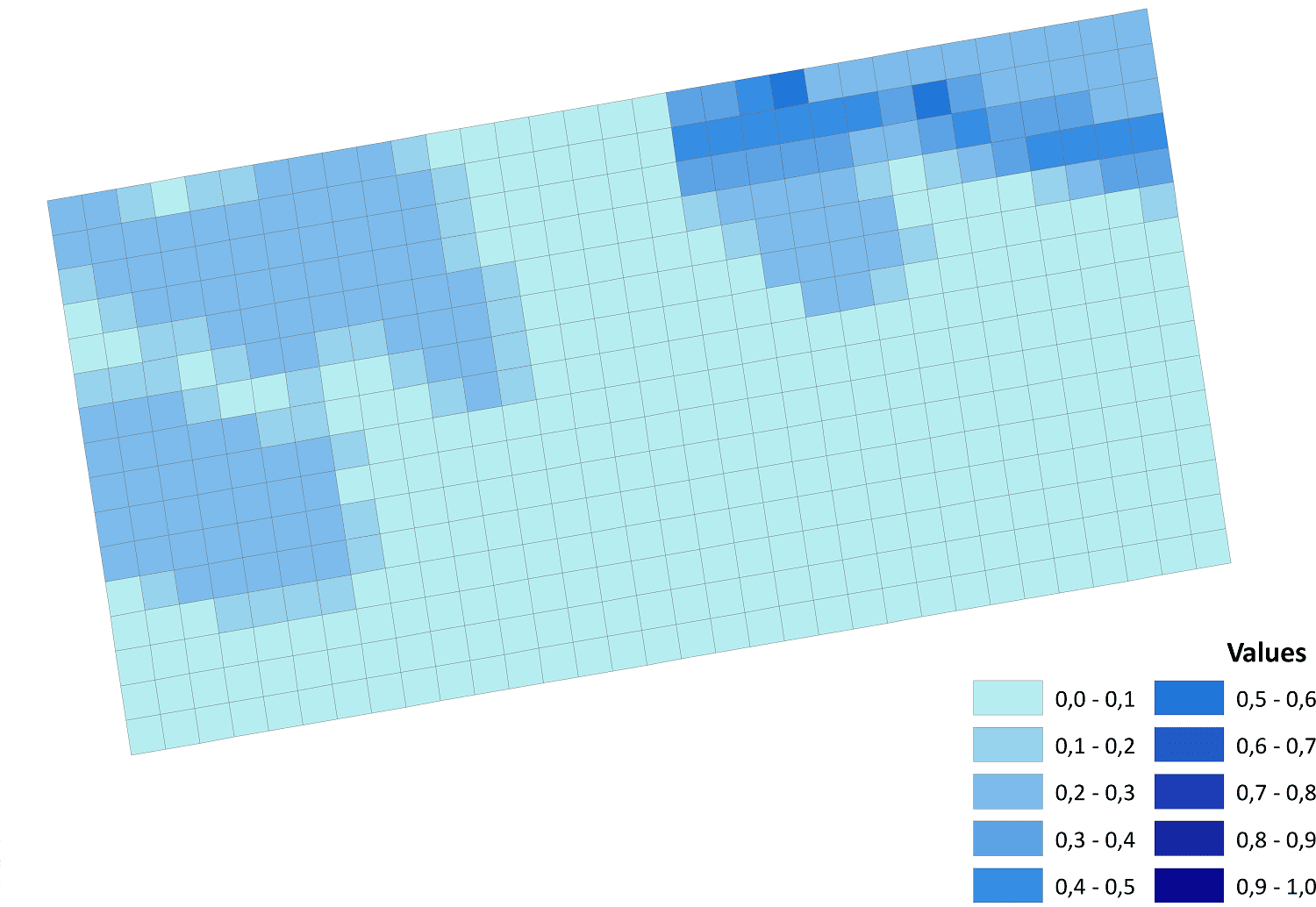
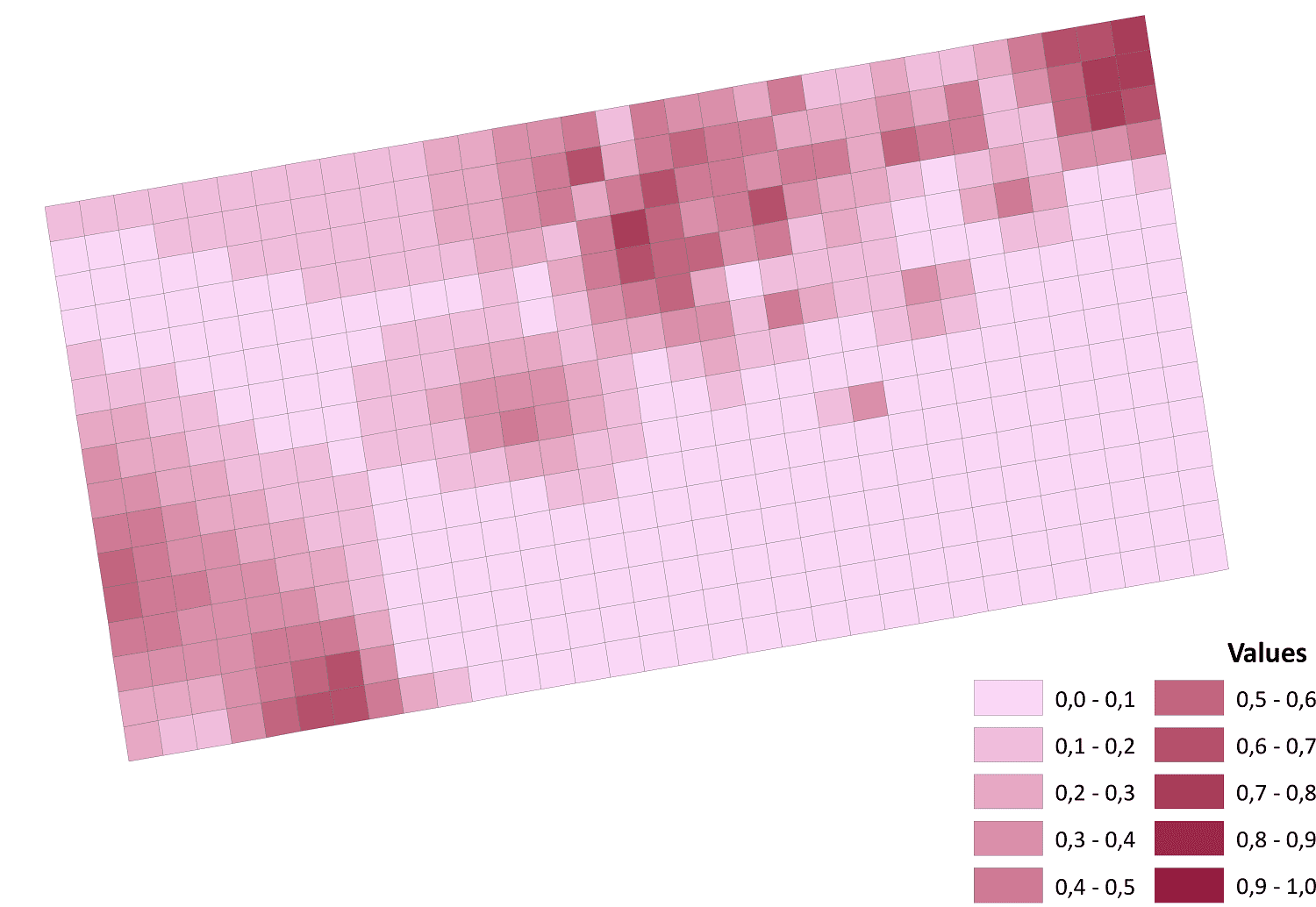
In this project, an evaluation of the feasibility of obtaining knowledge of the landscapes of the city of Granada from different dimensions was carried out by studying photographic information from a social network specialising in outdoor routes and itineraries through the analysis and labelling of photographs using Deep Learning Artificial Neural Networks. This information was grouped and presented using self-organising maps (SOM), AND Geographic Information Systems, which facilitated the obtaining of optimal clusters, the representation of these clusters in Geographic Information Systems, their interpretation by means of an Effect Size and p-value analysis and comparing the results with existing landscape catalogues. The objectives of this project were to evaluate the scientific interest of this methodology, to assess the possible extension of the research to other areas, and to publish and update the progress of the project.
Correo electrónico: info@gis4tech.com
