
The characteristics of the urban environment can determine that Andalusian adolescents are more or less active, spend more or less time in sedentary activities, travel actively or passively to school and have more or less adiposity. For this project, 243 participants from Granada, Jaén, Almería and Valencia between 15 and 16 years of age from 9 secondary schools completed questionnaires consisting of an assessment of their environment and answers to sociodemographic and economic questions. In addition, the routes followed by these adolescents to school were recorded and analyzed by GPS to later carry out an exhaustive analysis and obtain several indicators.
This project is part of the Call for R+D+i Projects within the framework of the Operational Program FEDER ANDALUCÍA 2014-2020 and its Principal Investigators are Palma Chillón, from the Faculty of Sports Sciences of the University of Granada and from the research group PROFITH UGR and Sergio Campos, from the Escuela Técnica Superior of the same university. The Project Manager is Daniel Molina and our participation has been materialized through the analysis of the data and the obtaining of indicators obtained through GIS tools.
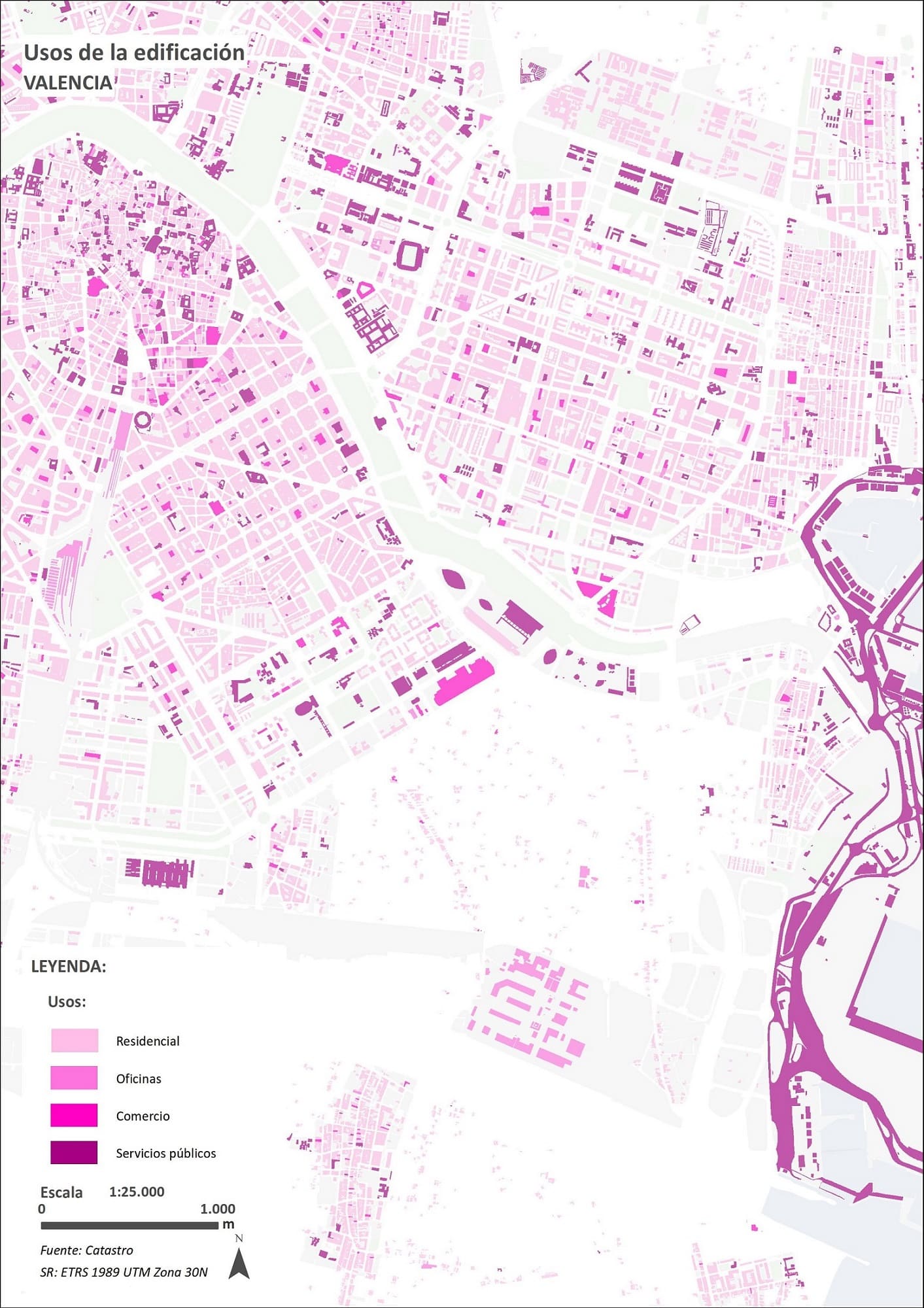
Cartography of Building Uses of the City of Valencia, Basis for Obtaining the Mixed Land Use Indicator.
The project has addressed objective measurement methods that assess the complexity of the urban environment as an essential physical support for the development of active behaviors and the extent to which environmental and individual aspects related to active behaviors and sedentary time interact
The main and general objective of the project is to understand the influence of the urban environment on the physical activity behaviors and sedentary time of Andalusian adolescents. The specific objectives are as follows:
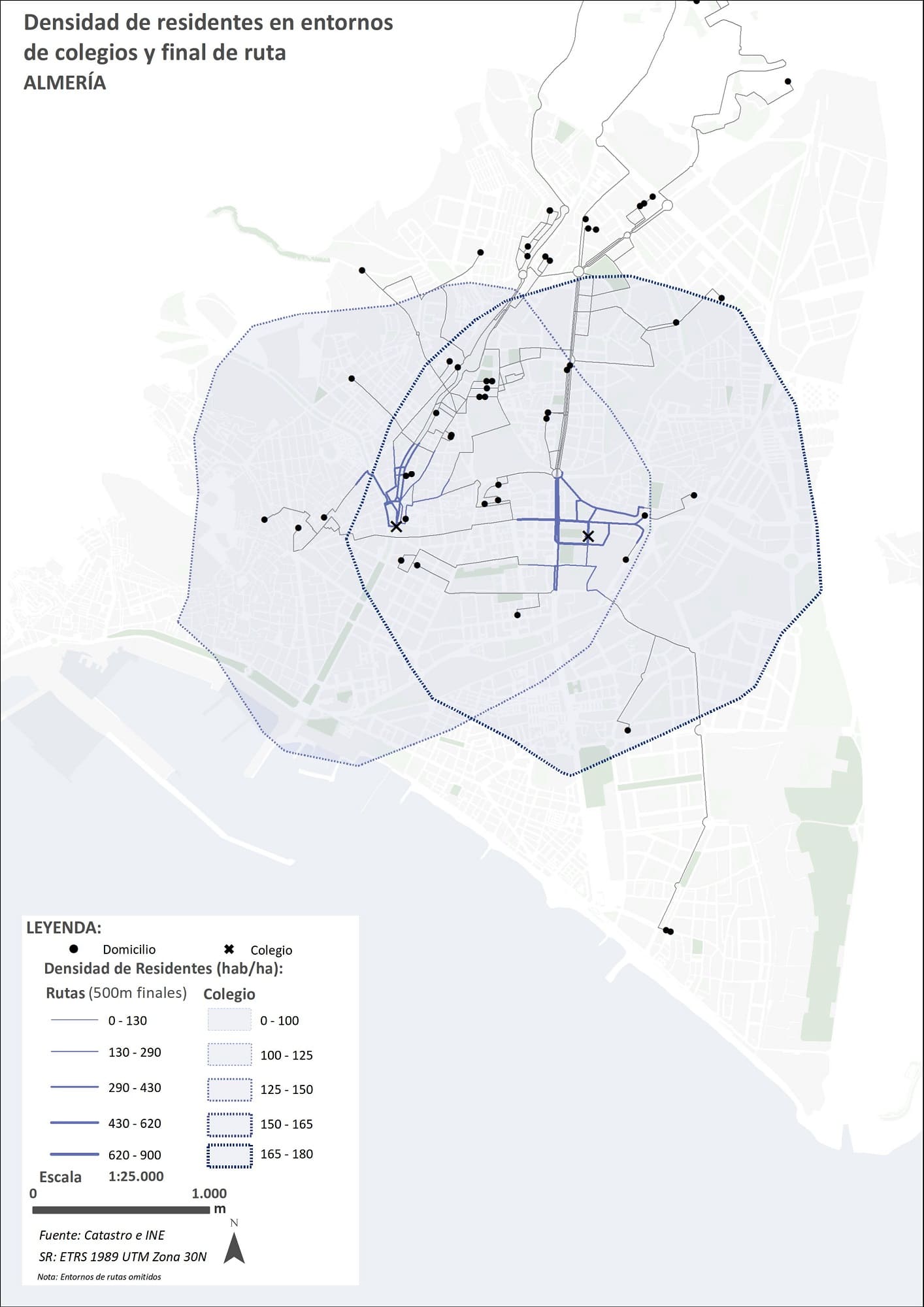
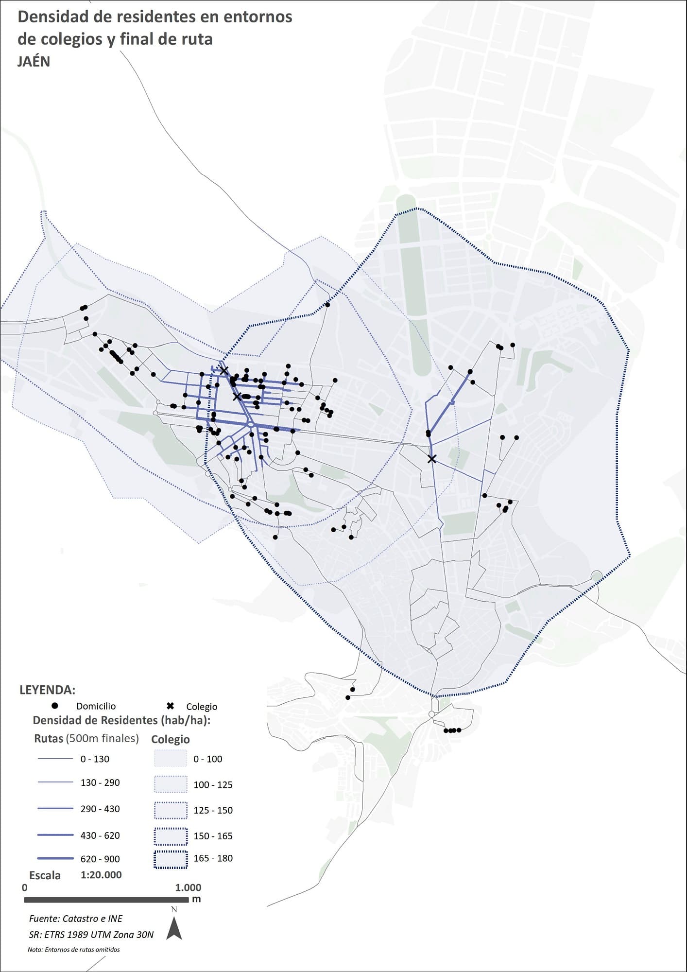
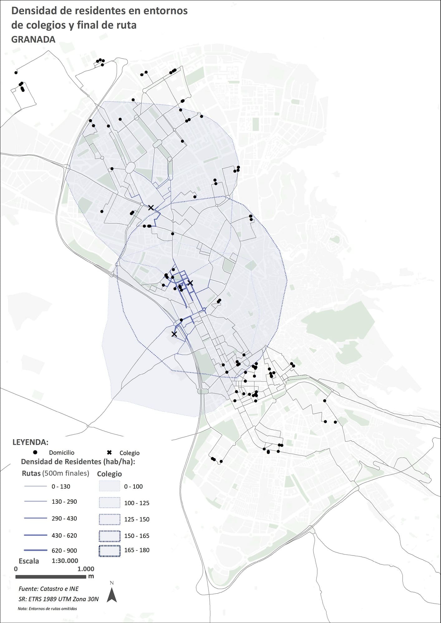
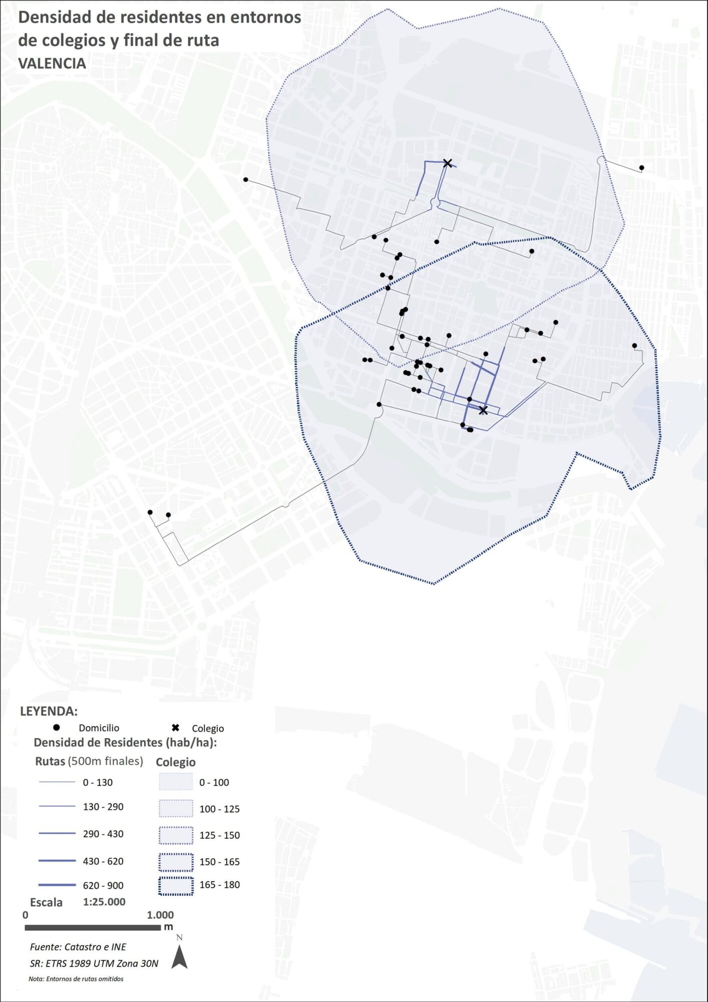
Mapping of Resident Density Indicator in the Final 500 Meters of the Route to the Schools
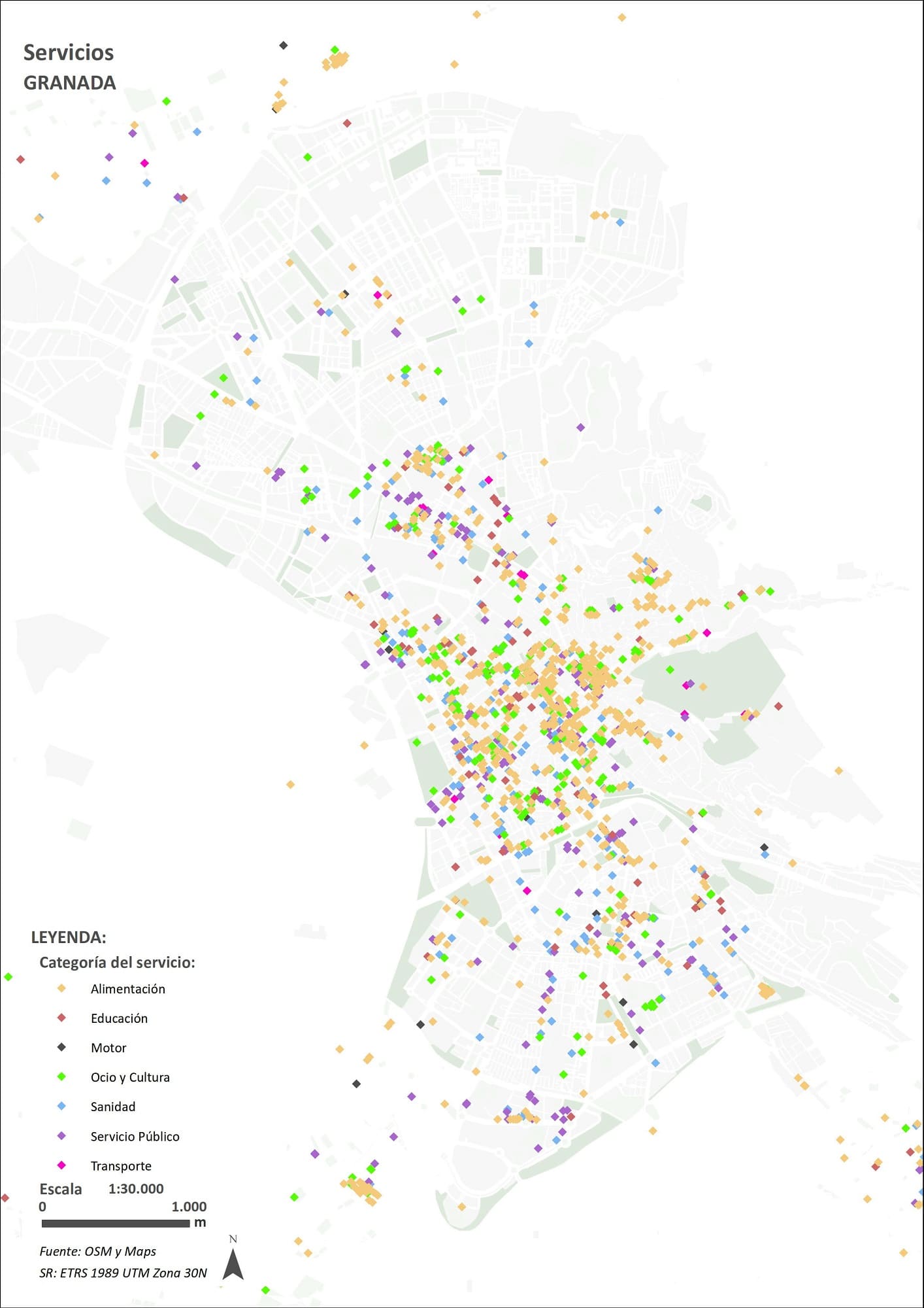
Services Cartography of the City of Granada, Basis for Obtaining the Mixed Land Use Indicator.
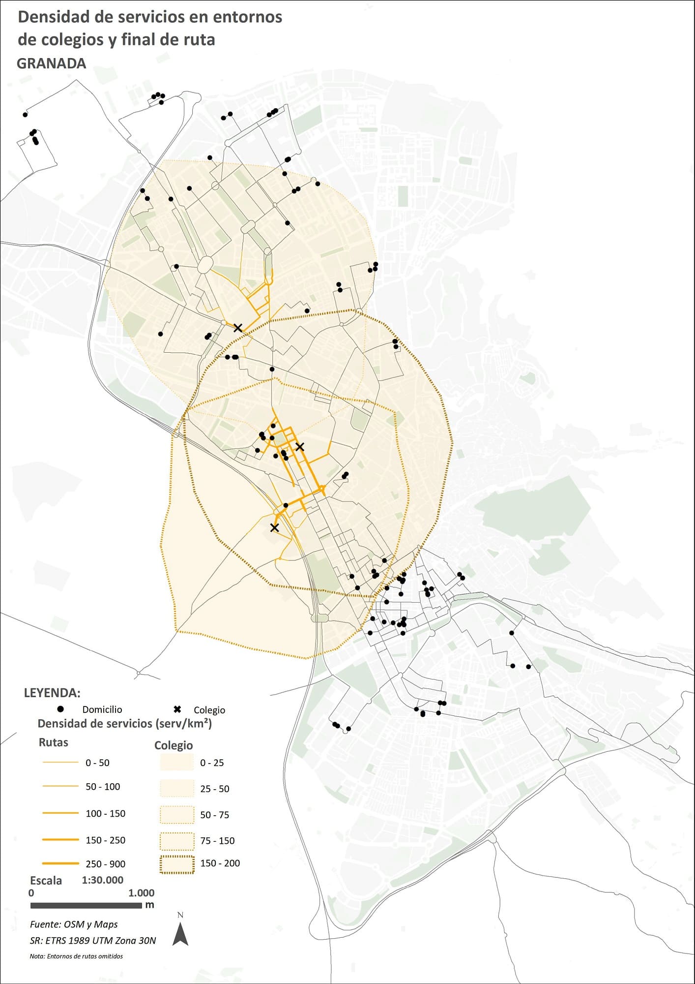
Service Density Indicator Mappings in the Final 500 Meters of the Route to the Schools
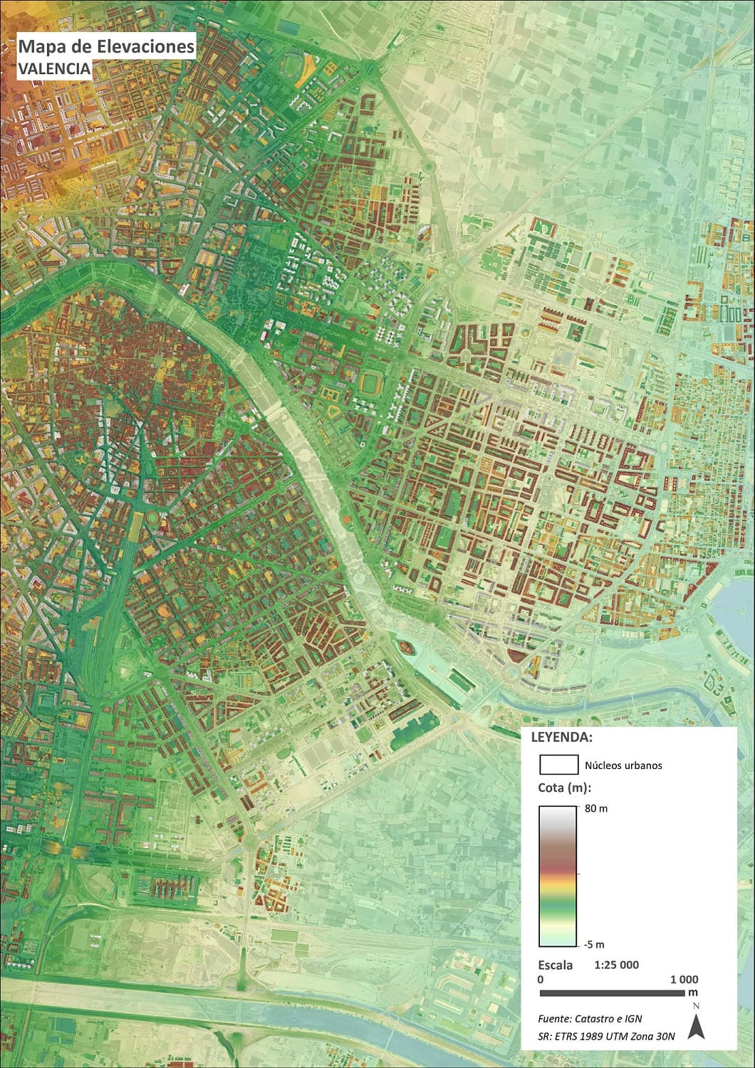
Elevation Cartography of the City of Valencia, Base for Obtaining the Visibility Indicator of the Routes to and from the Schools.
The joint use and comparison of the indicators is going to reflect very useful information for the different cities on the factors (whether environmental or socio-demographic) that affect children's and adolescents' travel to schoolThis will provide clues to develop urban plans that favor and facilitate active travel and citizen actions to reduce sedentary lifestyles and achieve higher levels of activity among children and adolescents.
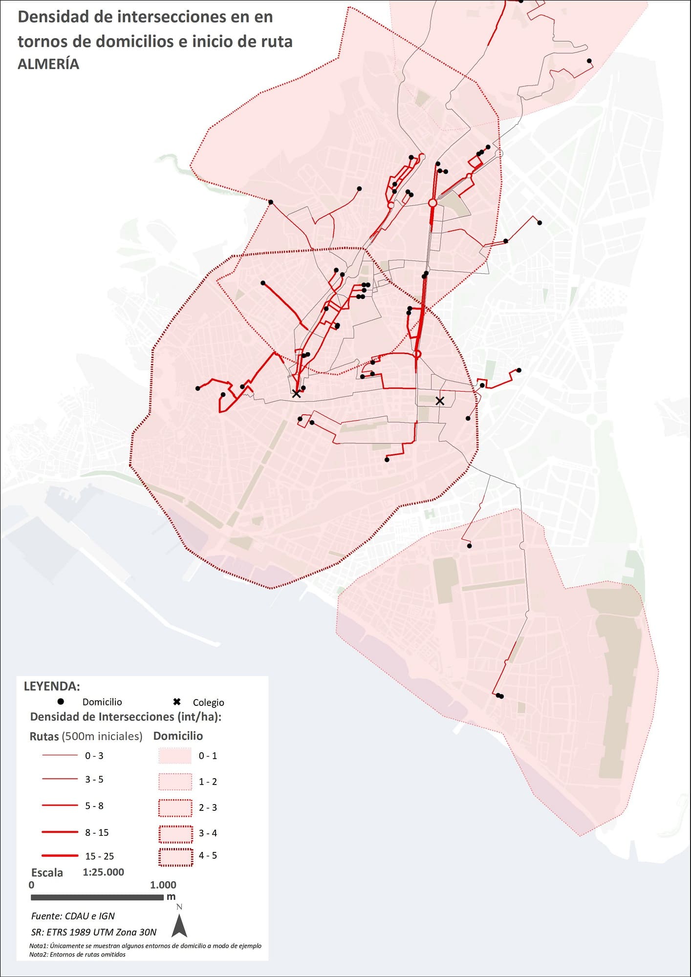
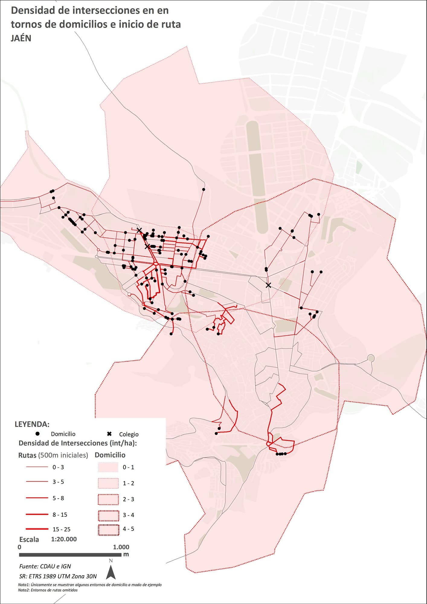
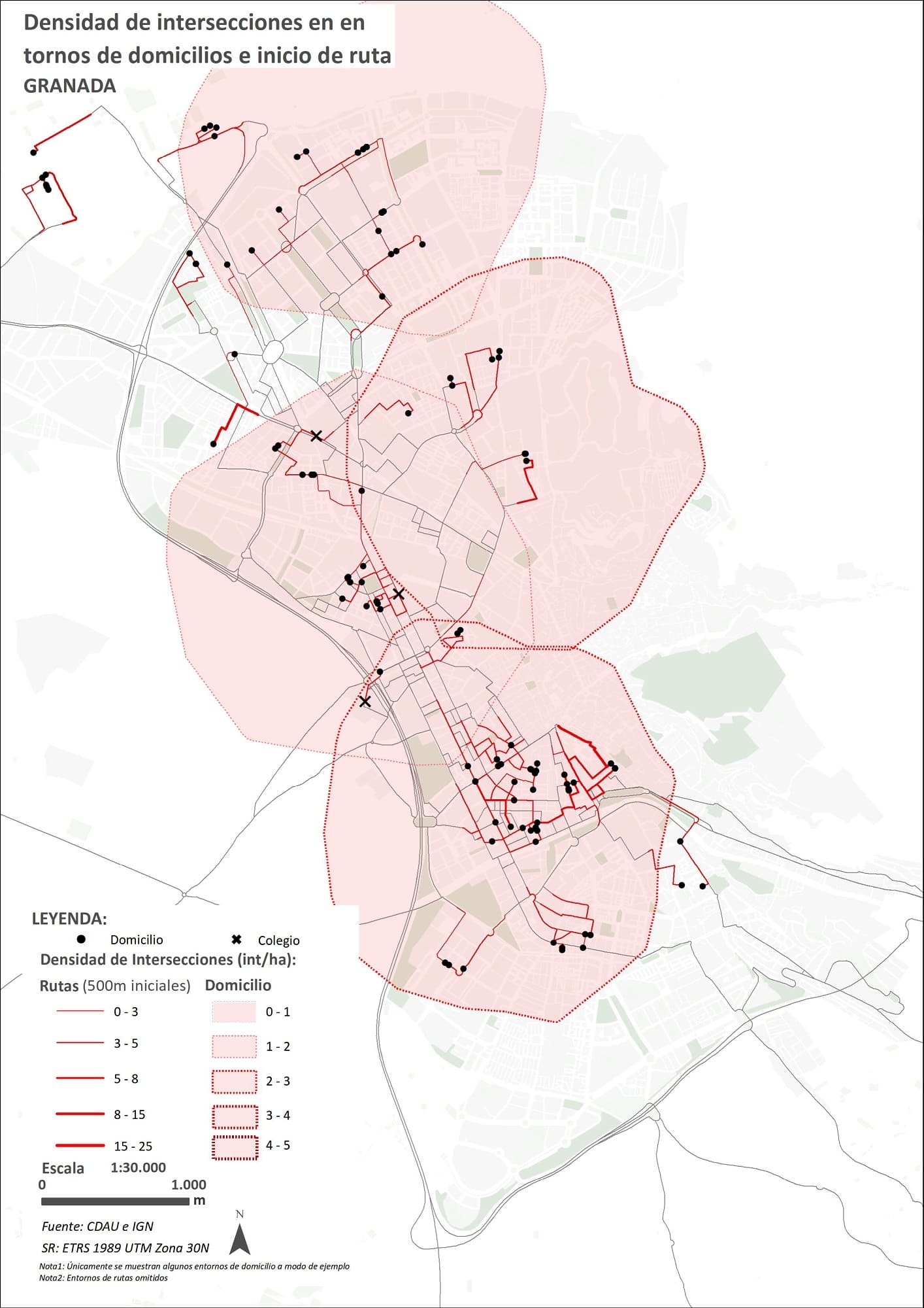
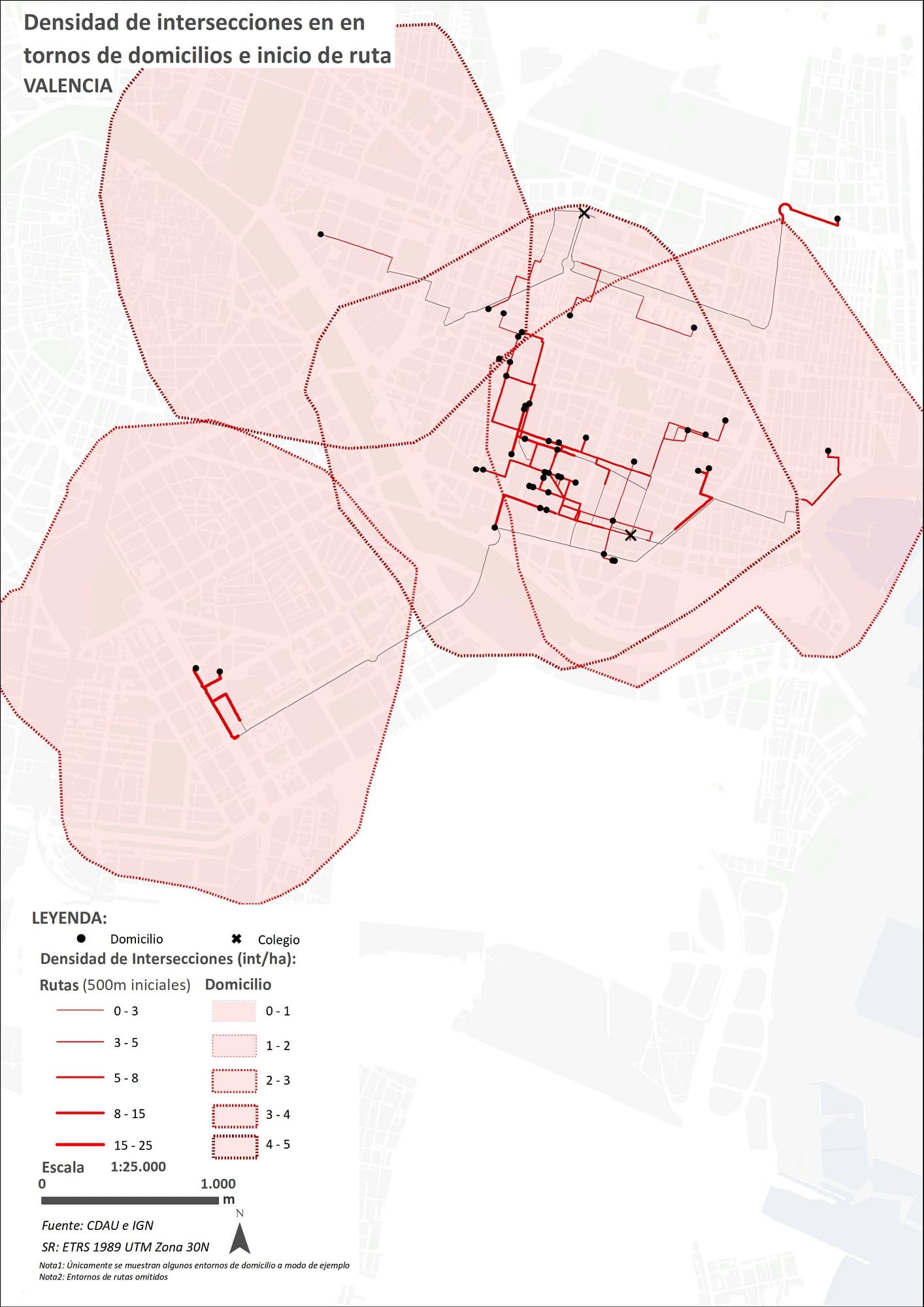
Cartographs of the Intersection Density Indicator in the initial 500 Meter Route from Homes
Some of the methodologies used have been co-developed by Sergio Campos, professor at the School of Architecture of Granada, Principal Investigator of the study and partner of GIS4tech., como son "Accessibility of Two Urban Forms of the Inner Periphery. Configurational and Visibility Analysis.", "Integration of Configurational Variables in the Study of Urban Cycling at the Intermediate Scale." and "Spatial-Configurational Analysis and Decision Support in Urban Open Spaces of Andalusian Cities through Complementary Approaches.".
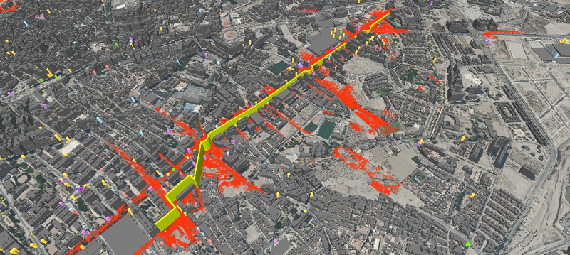
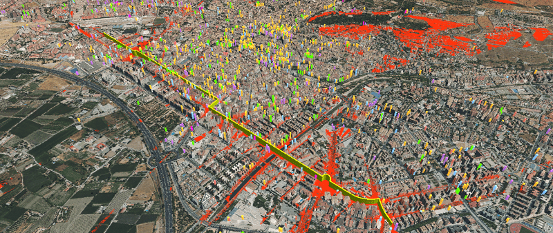
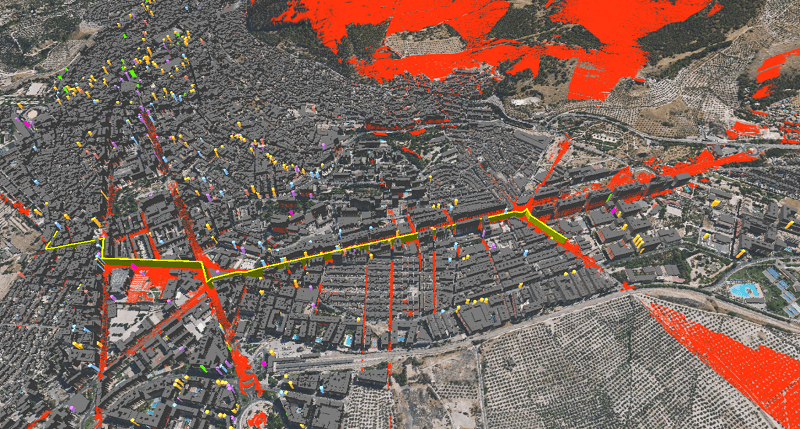
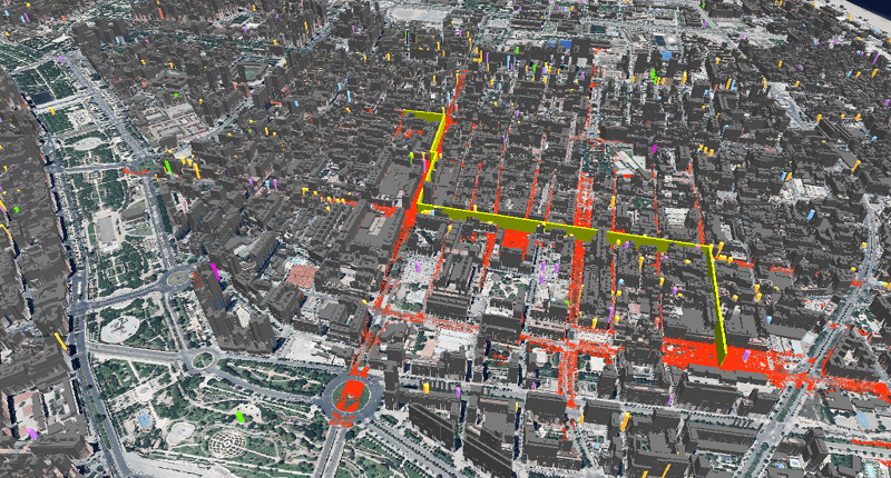
Visibility Indicator for the cities of Almeria, Granada, Jaen and Valencia.
Correo electrónico: info@gis4tech.com
