We work closely with NGOs in the humanitarian field offering solutions through GIS, Data Analysis and Artificial Intelligence. In addition, we are committed to developing rural areas in Latin America and Africa and improving the quality of life of their communities with the aim of making them self-sufficient. We are specialists in the use of these technologies to assist non-profit organisations and government entities in the following areas:
CLIMATE
NUTRITION
POPULATION
ECONOMY
DISEASES
MIGRATIONS
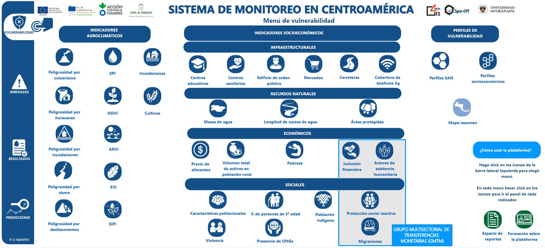
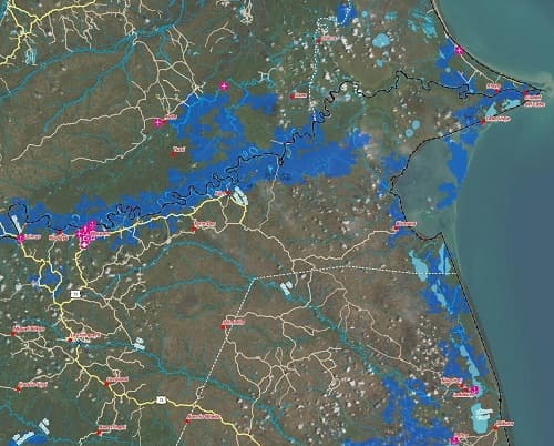
We collect, process and reflect information on socio-demographic data (food prices, poverty, violence...), natural disasters (hurricanes, floods, earthquakes or volcanic eruptions), agro-climatic data (state of vegetation and crops) or infrastructural data (presence of educational or health centres...), to facilitate decision-making and action by humanitarian NGOsThe ultimate goal of all this is to ensure that the emergency response is consistent and efficient, such as knowing where to focus its efforts consistently and efficiently, proactively detecting risks to vulnerable populations, or taking emergency action following sudden events. The ultimate goal is to Improving Food and Nutrition Security in developing country communities, as is the case with the malnutrition in GuatemalaThe aim is to promote a minimum and regular availability of food and to enable both access to and production of food.
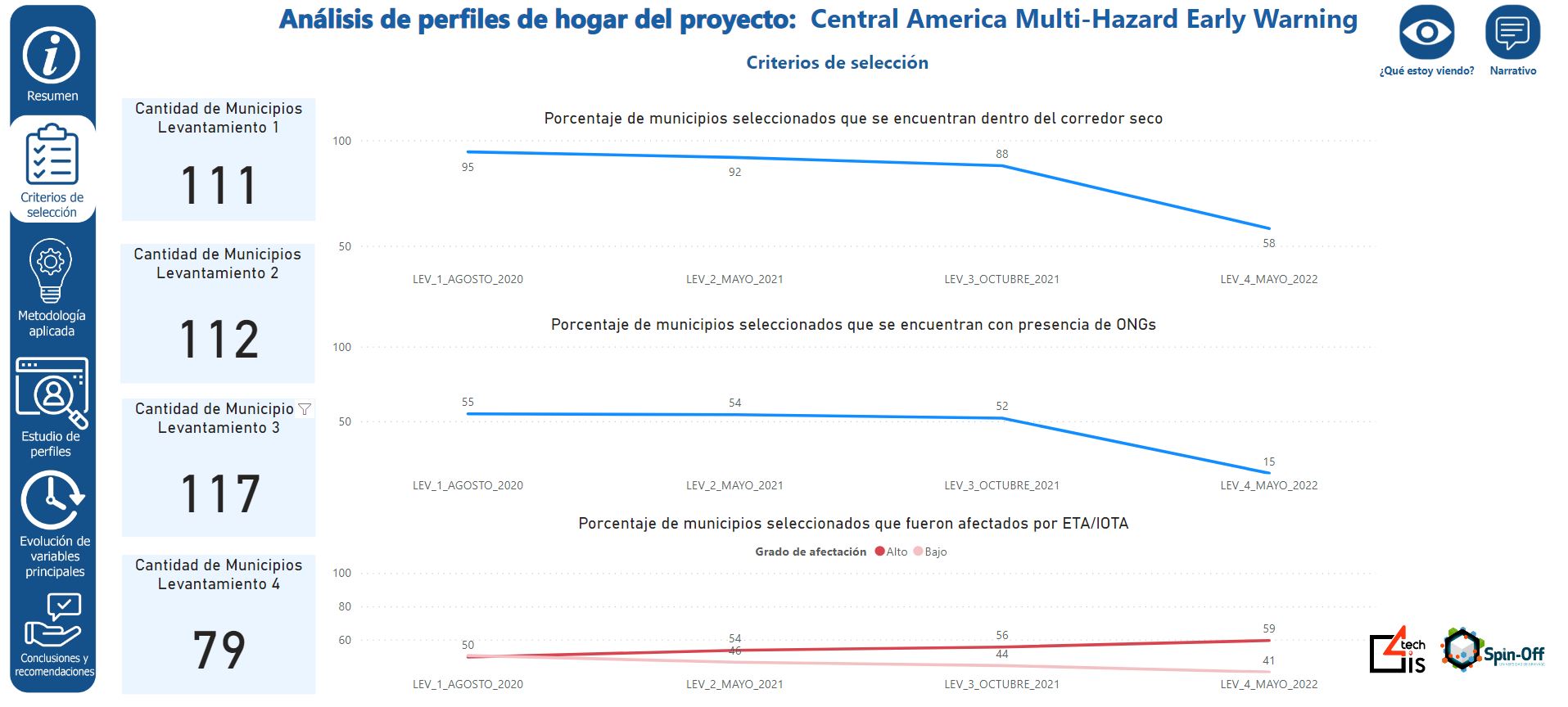
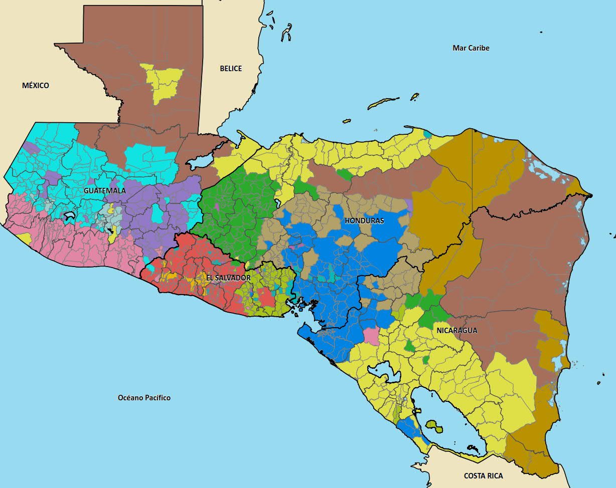
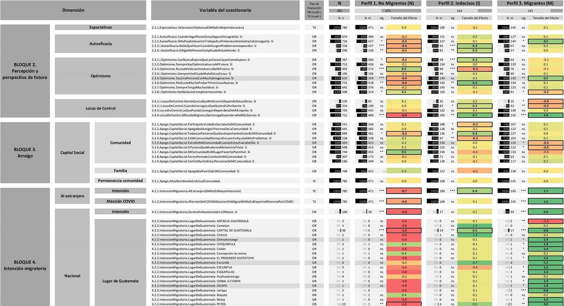
Real-time monitoring information is essential to try to improve the situation of municipalities and vulnerable populations, that is why in GIS4tech we have developed two platforms to help non-profit organisations, the first one, PREDISAN, where we generate visualisations to monitor indicators of vulnerability, hazards, impacts and outcomes that provide valuable information and help to improve joint and unified work between organisations and institutions, such as Acción Contra El Hambre, ECHO, AECID, AACID or USAID, and the second, DATAFACE, in which we apply Artificial Intelligence techniques to detect groups of individuals with similar characteristics and facilitate the prioritisation of actions, the measurement of the effectiveness of humanitarian interventions and the optimisation of resources in humanitarian response.
Platforms we have developed for the humanitarian sector: