The Method for Calculating the Homogeneity of Land Uses in a City

Citizens need to change their travel behavior to avoid sedentary lifestyles and contribute to the reduction of pollution in citiesTo this end, cities should probably restructure their urban structure to be pedestrian-oriented rather than car-oriented, facilitating walking and cycling and encouraging the creation of green spaces. We have a method for calculating the homogeneity of land uses in a city.

CiudActiva Project

These desires are being translated into the project CiudActivawhich we are carrying out together with the research group PROFITH UGR.

Our part consists of the analysis and processing of sociodemographic and environmental perception data to obtain various urban indicators in the cities of Almeria, Granada, Jaen and ValenciaThe results will help to make decisions regarding the urban planning of the cities.

Mixed Use Indicator

This index captures how evenly the areas of various land uses (residential, commercial, offices and facilities) are distributed in each environment. 

This helps us to comprobar la homogeneidad o heterogeneidad de los usos de los edificios en los entornos de domicilios y colegios. The results of this study show evidence of the concentration or disaggregation of uses, the influence this may have on other indicators studied and the consequences for the home-school displacement of boys and girls.

This is a dimensionless parameter with values between 0 and 1 that represents the distribution of the different uses that can be defined in the buildings, with a value of 1 being a homogeneous distribution (equivalent distribution).

The formula that is part of the method for calculating the homogeneity of land uses in a city:

Formula del método para calcular la Homogeneidad de los Usos del Suelo en Una Ciudad

Cartography of Building Uses of the City of Valencia, Basis for Obtaining the Mixed Land Use Indicator.

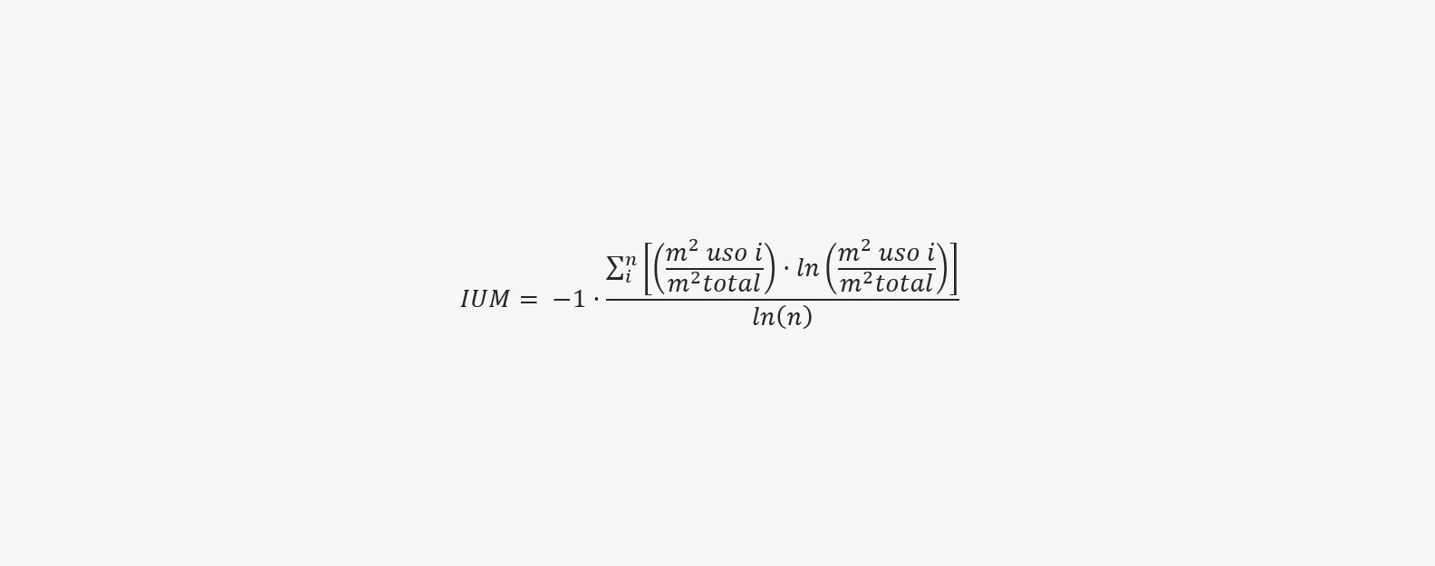
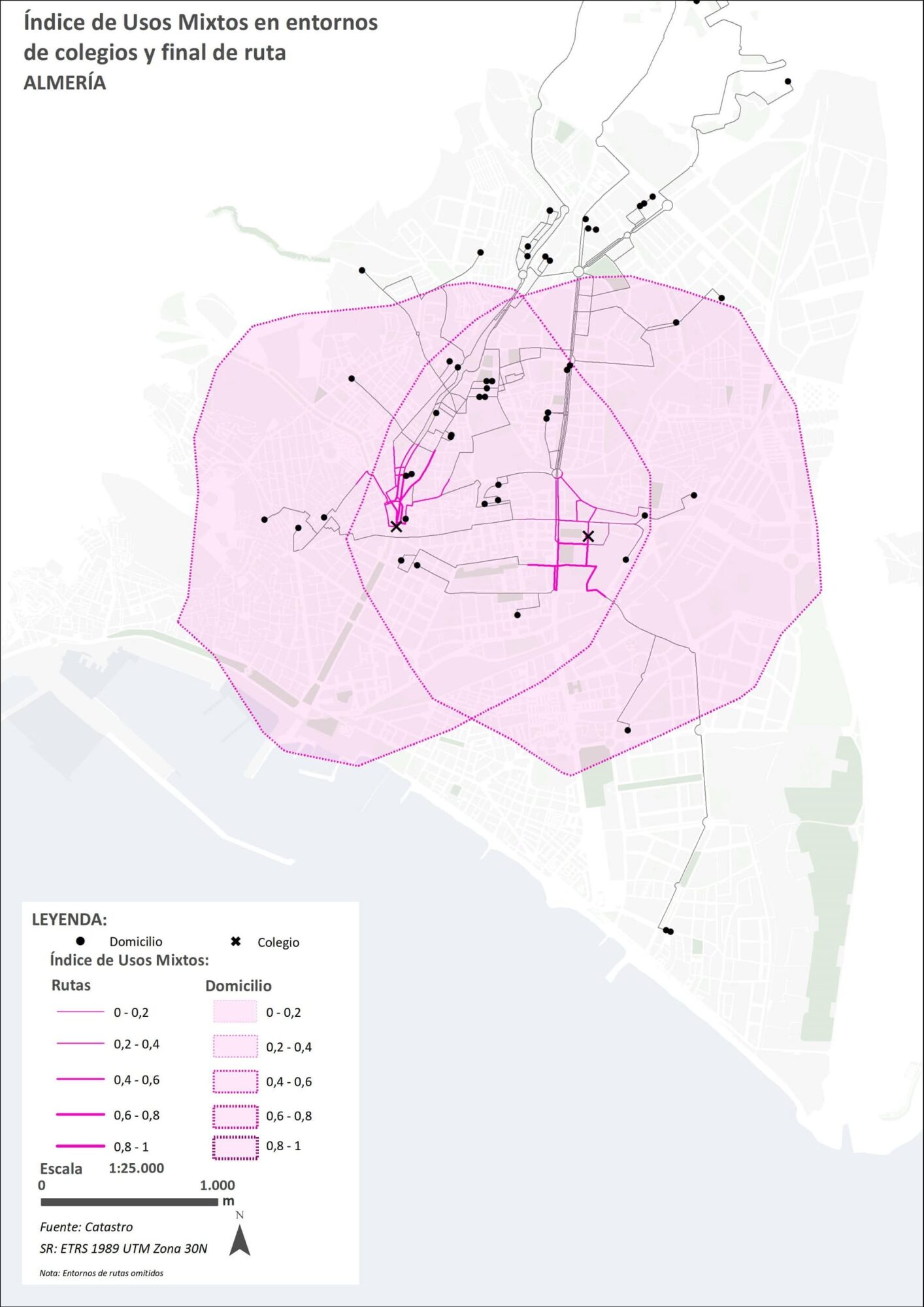
Where n is the number of uses to be considered and i is the iteration corresponding to each one of them. In our case, we will consider four land uses (n = 4), which will be the residential, commercial, offices and facilities. Therefore, for the calculation of this index we will start from the cadastre layer called "CONSTRU" which offers in a field the use destined to each building and its area.
Capa de edificios base para Formula del método para calcular la Homogeneidad de los Usos del Suelo en Una Ciudad

Layer of Almeria Buildings by Use

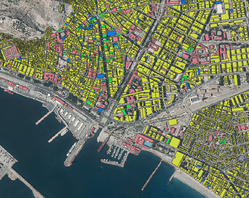
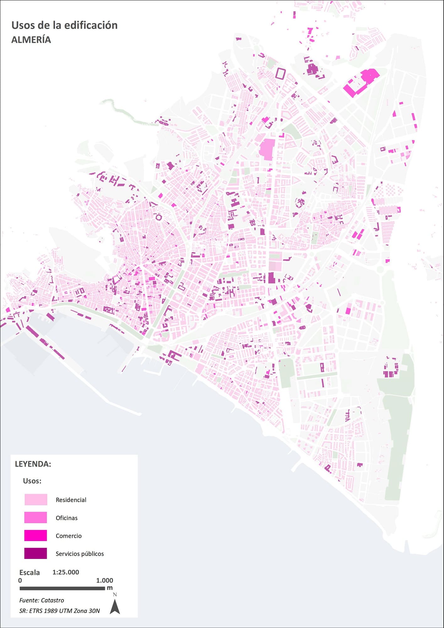
After obtaining the layer of buildings with the data of the area and the use of the building we will be able to extract for each environment under analysis the buildings that are captured. Then, to make it easier to understand and "personalize" the plan, we proceeded to the symbolization of the layer:
Cartografía base de los usos de la edificación en Almería

Symbolization of the Almeria Building Layer by Use

With this we will be able to calculate the index for each of the environments and observe the level and mode of distribution that exists in the area.

Índice de usos mixtos de la ciudad de Almería para el proyecto CiudActiva

Indicator of Mixed Uses in School and End-of-Road Environments in Almeria

This, along with other indexes that we have used for the project are supported by several scientific methodologies developed by our partner and professor at the Escuela Técnica Superior de Arquitectura de Granada Sergio Campos: "Accessibility of Two Urban Forms of the Inner Periphery. Configurational and Visibility Analysis.""Integration of Configurational Variables in the Study of Urban Cycling at the Intermediate Scale." and "Spatial-Configurational Analysis and Decision Support in Urban Open Spaces of Andalusian Cities through Complementary Approaches.".
Comparte en:

Do you have doubts about the method for calculating the homogeneity of land uses in a city?

error: Content is protected !!